-
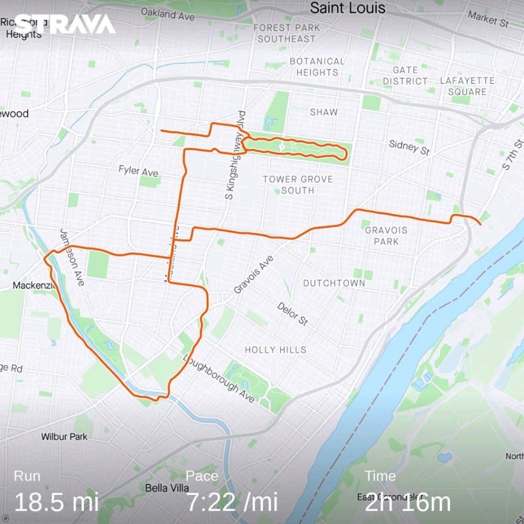
Daily Run Diary: 8 December 2025 – 19 Mile Long Run

My training plan called for me to run 14-21 mi at a 7:08/mile average pace. I was originally supposed to run this long run on Sunday, but because I slept in a lot on Saturday, I moved Saturday and Sunday’s workouts back a day.
Once again today I overslept. I was planning to do the long run in New York before I flew back to St. Louis but again I slept in. I barely made it to the train on time to get to my flight 15 minutes before the scheduled departure. Luckily the flight was delayed a little bit so I had enough time to not miss my flight.
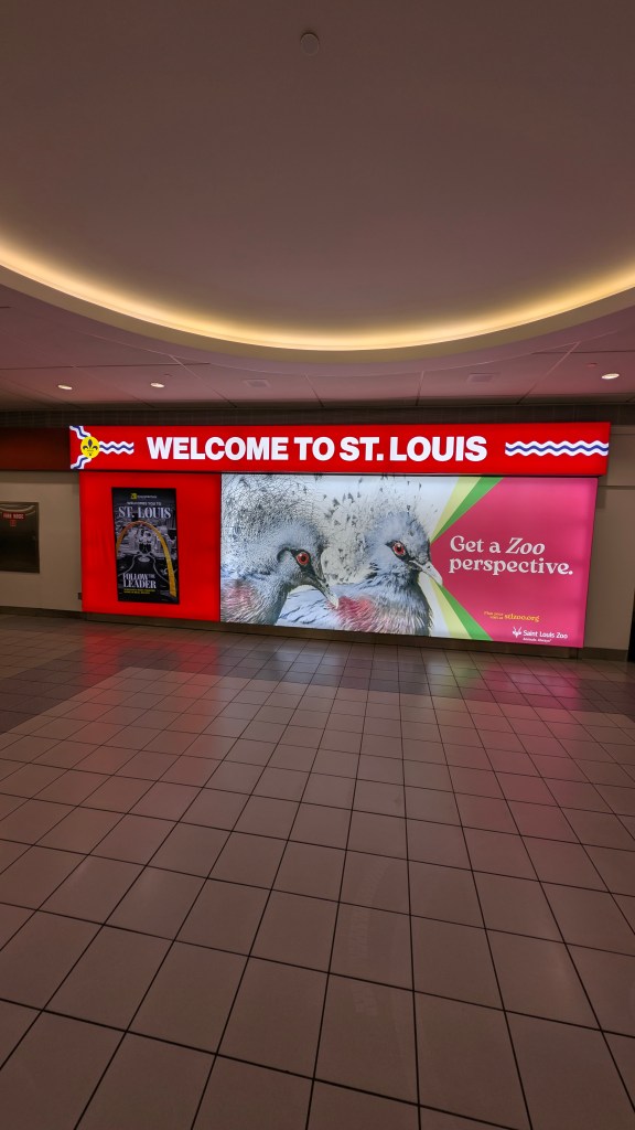
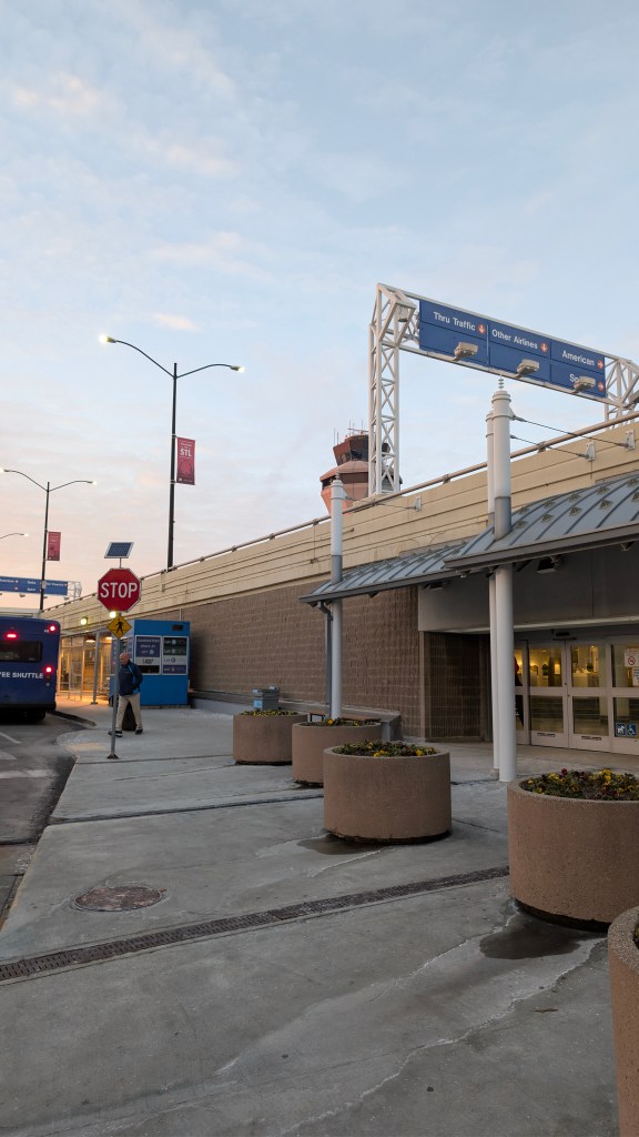
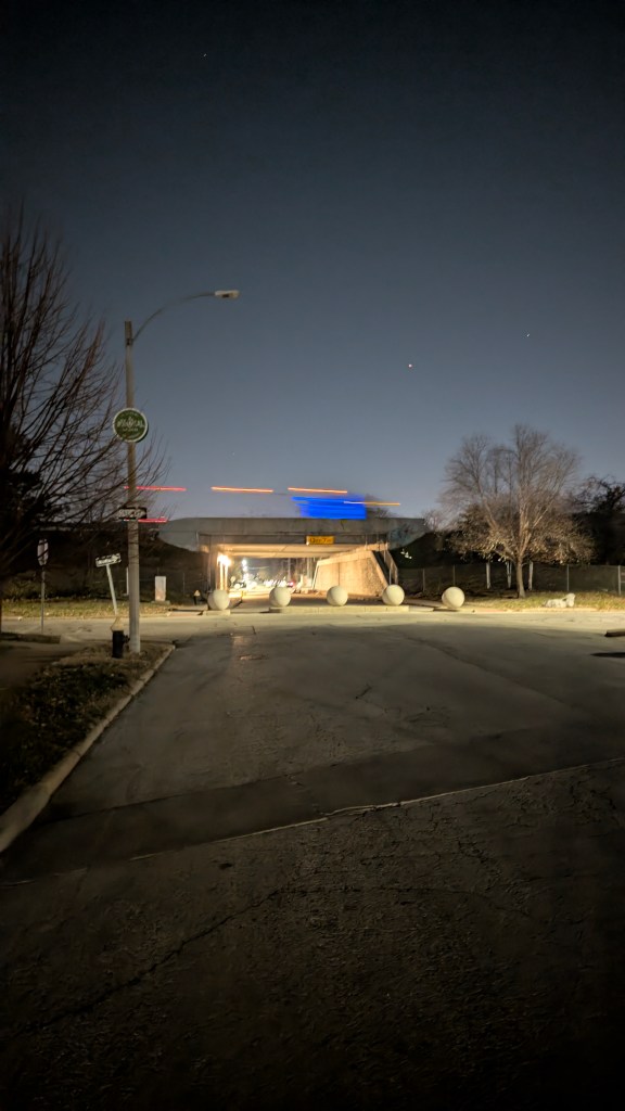
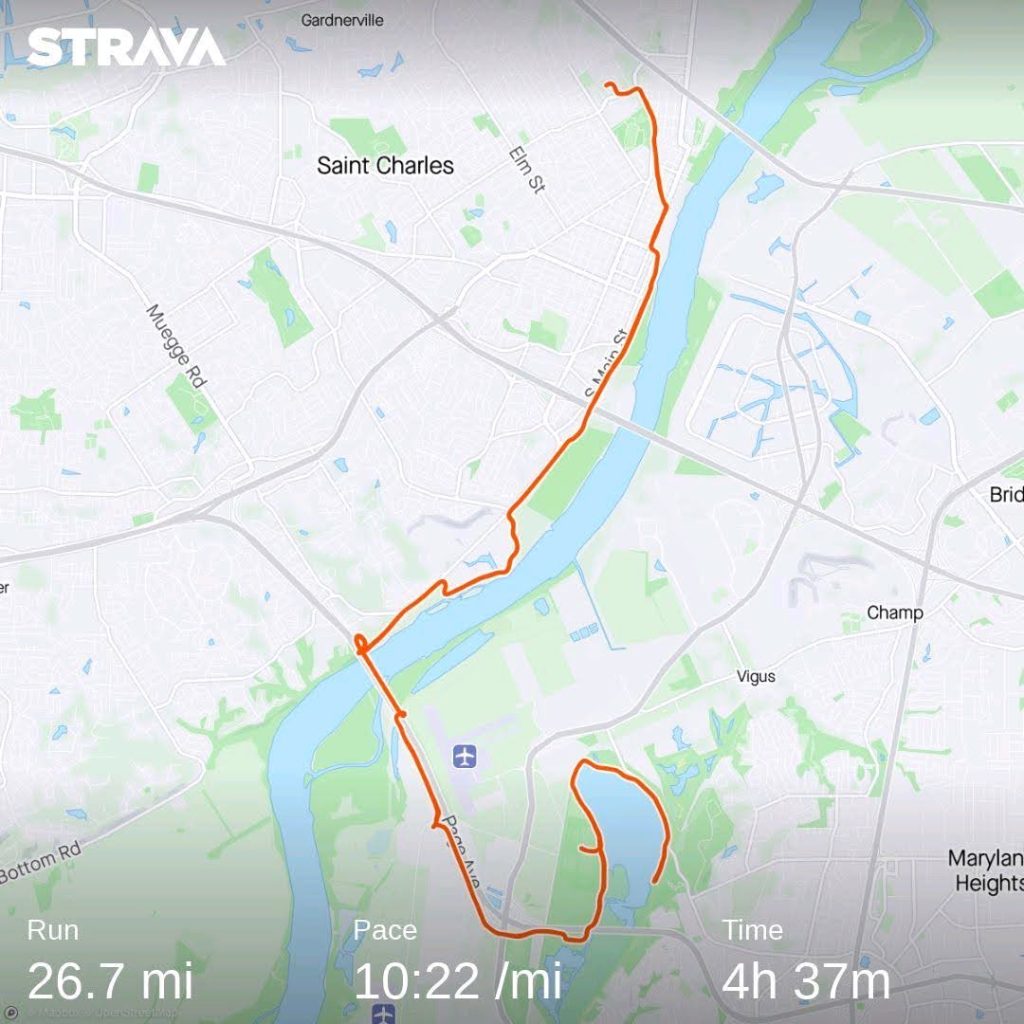
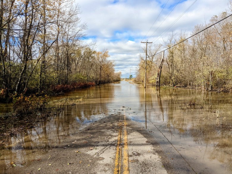
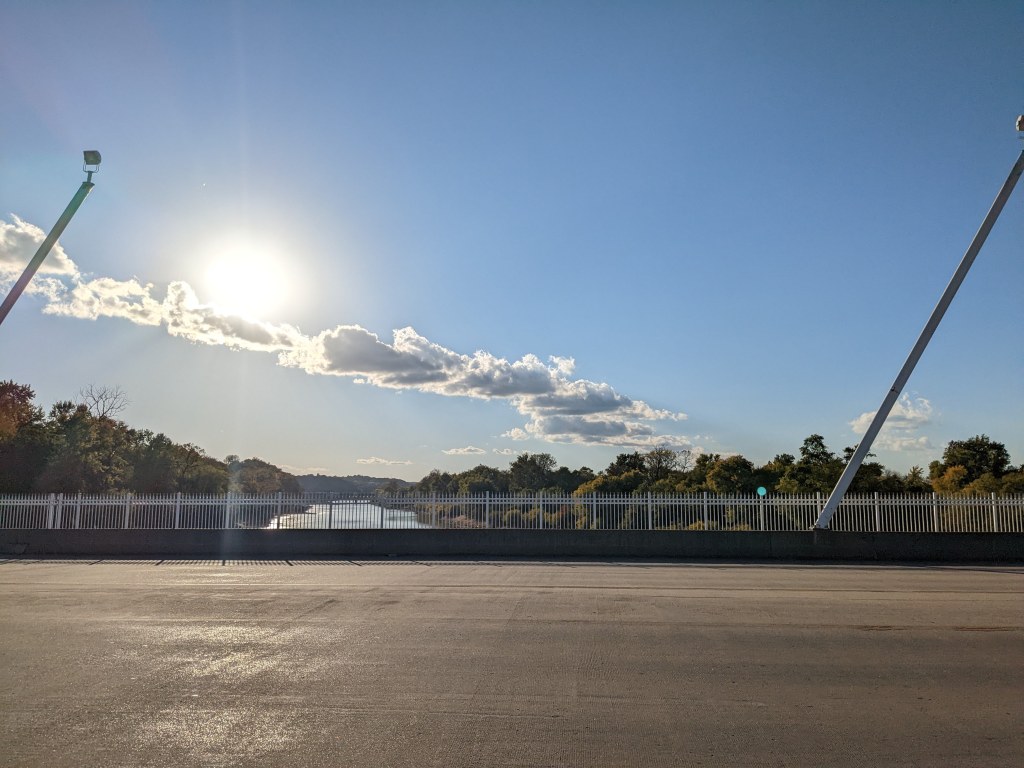
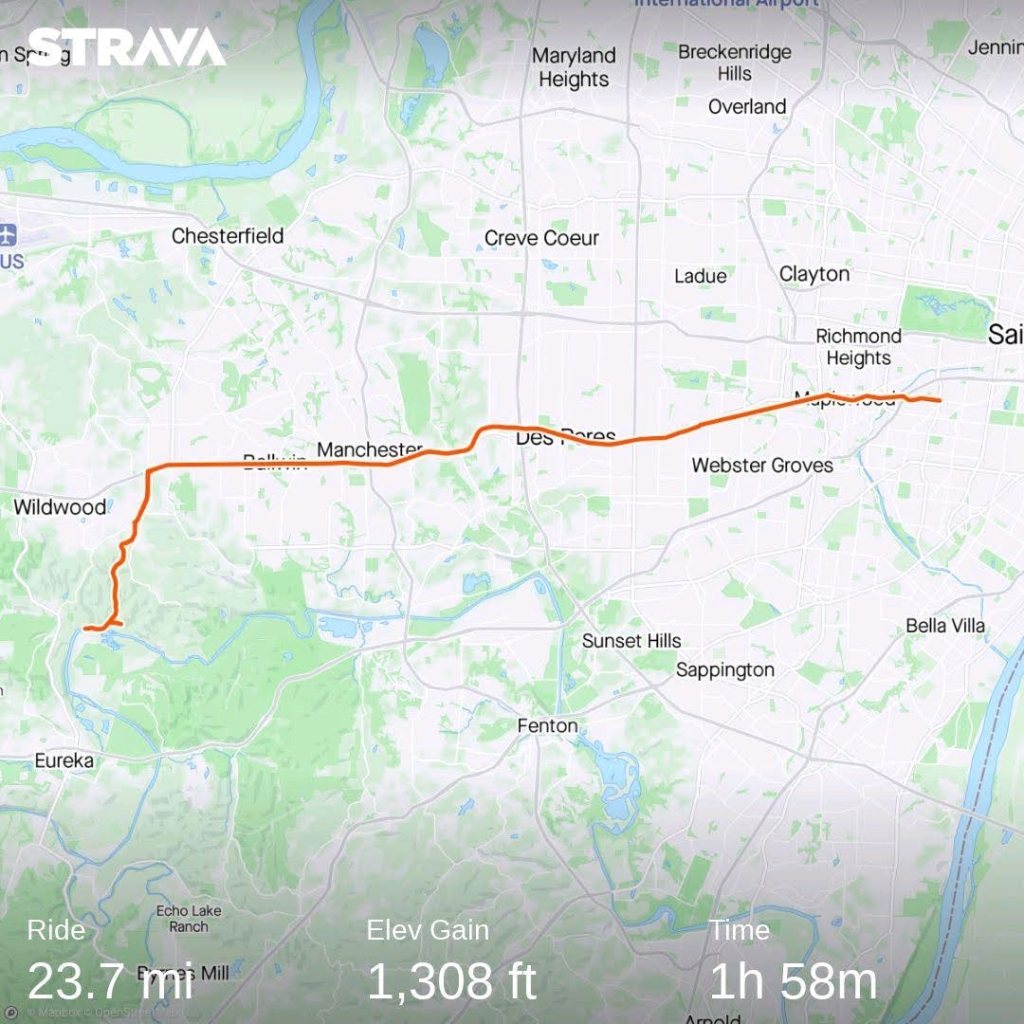
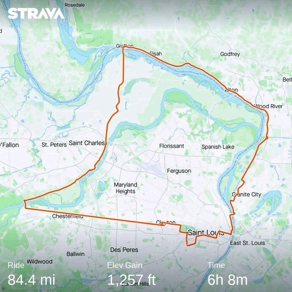
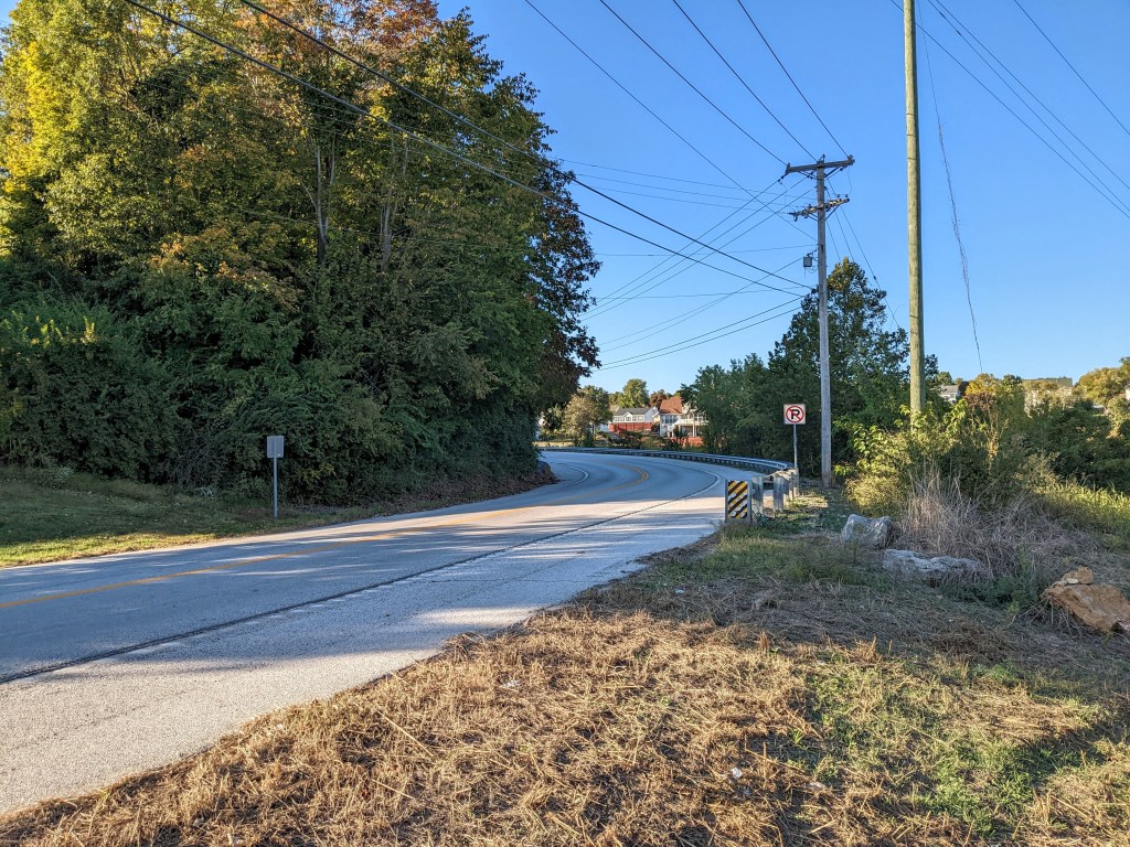
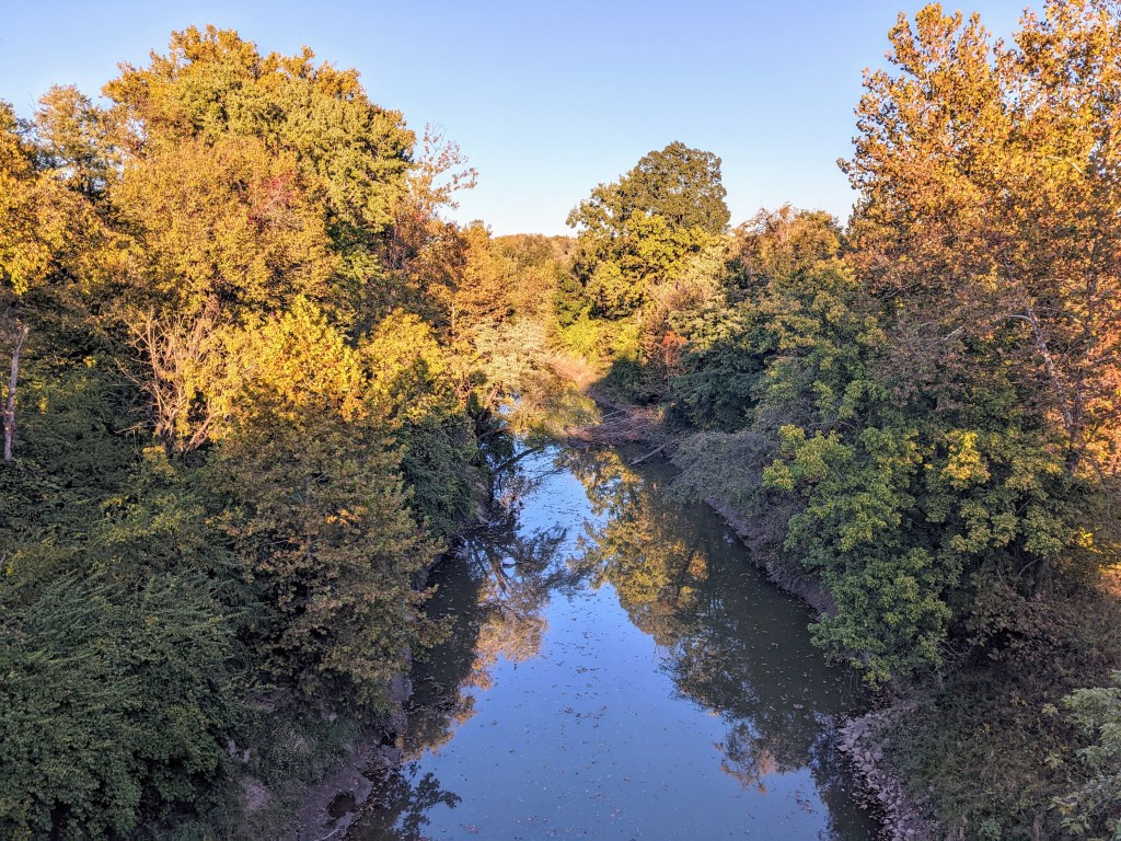
When I arrived at the St. Louis airport, I decided I would run from there. I have lived in St. Louis for almost 13 years and have never run to or from the airport and thought today would be the day I tried it. I packed light with only my winter coat, phone charger and a pair of dress pants and dress shirt which all fit into a small drawstring bag. I mapped out my route trying to avoid major roads and set off for my long run.
The first mile was the most difficult trying to navigate out of the airport. I ran through a parking garage and across a few intersections without sidewalks or crosswalks. I was not the only one on foot but it was definitely not an area designed for pedestrians.

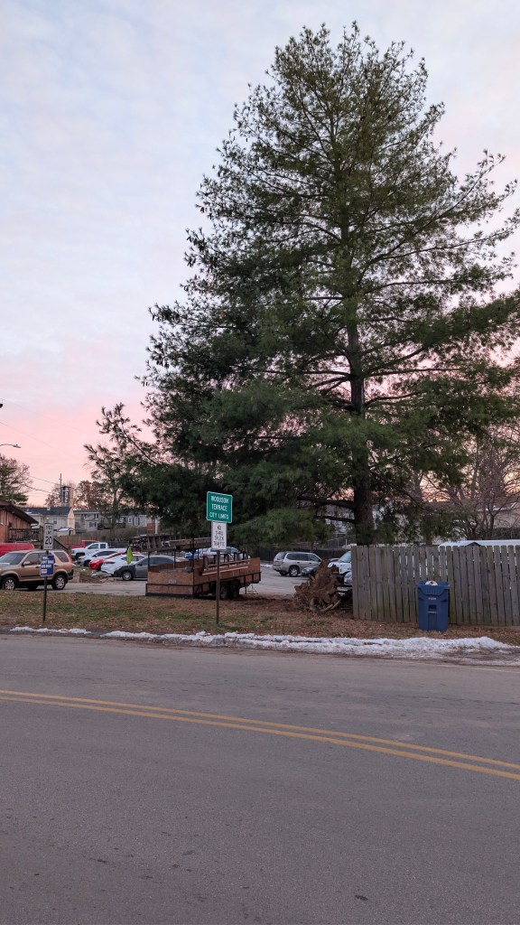
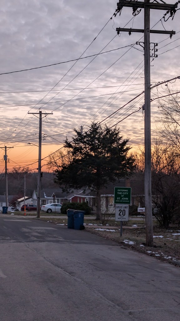
Miles two through three were hilly but less eventful. I was running through residential subdivisions enjoying the sunset. I would say the streets had a sidewalk about 50% of the time.
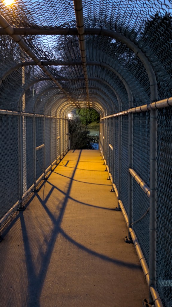
Miles 3-4 were a bit hilly and this was where I crossed. I-170 on a pedestrian-only overpass. It was nice to be separated from cars but but it was a little lacking in its maintenance with icy steps and mud covering the path.

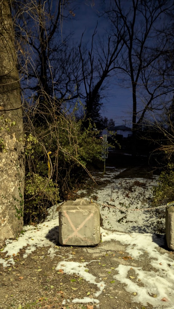
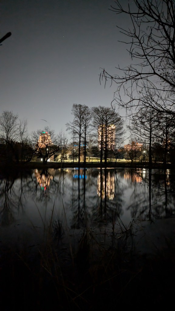
For the next mile I got a little lost trying to avoid running on Hanley road for too long. I eventually found the Bel-Ridge Park which was partially in a state of disrepair but still pretty.

Miles 6-7 were again through residential subdivisions. For miles 7-8, I ran through St. Vincent Park which had a few patches of thick snow and ice that had not melted yet.


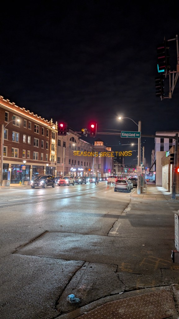
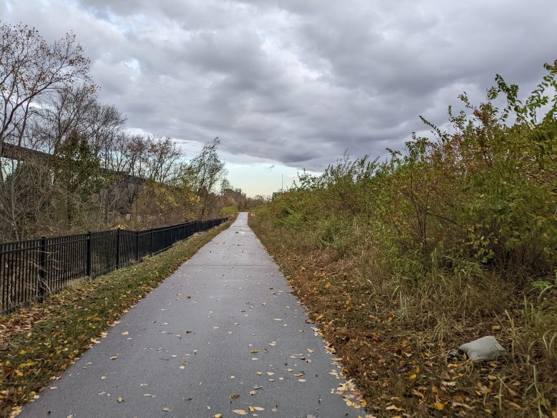
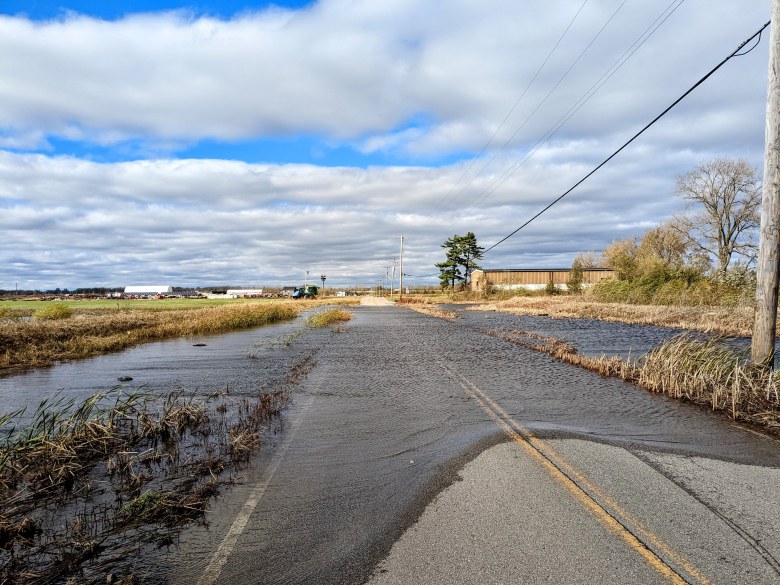
Next I ran down St. Charles Rock Road and Ferguson Avenue which were a little busier but I could see that Great Rivers Greenway has been working on expanding the St. Vincent bike trail with marked/separated shoulders and wider sidewalks. Some of these are still under construction so I had to run in the road for a bit. I saw some festive decorations on Delmar Avenue in University City.
At mile 11, I ran through part of the Washington University in St. Louis campus and after mile 12 I was in Forest Park. I encountered more construction here at Mile 14 and had to run on the road.
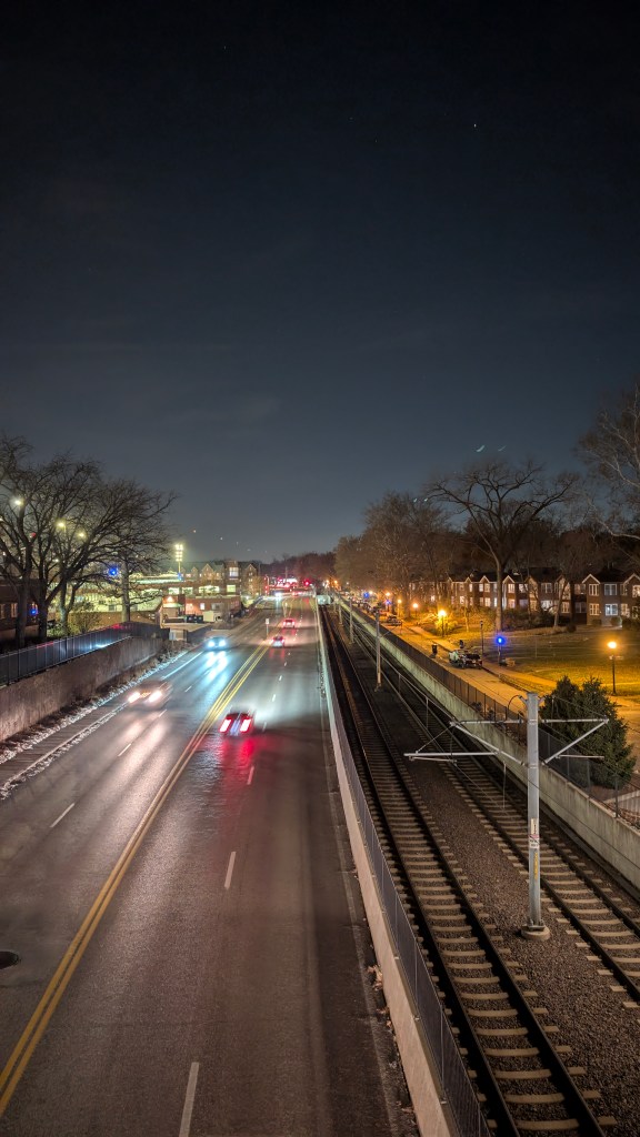


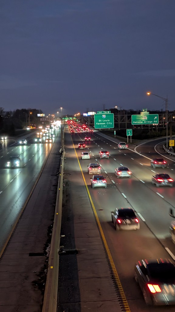
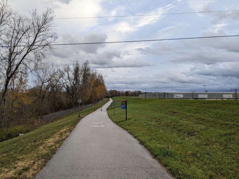
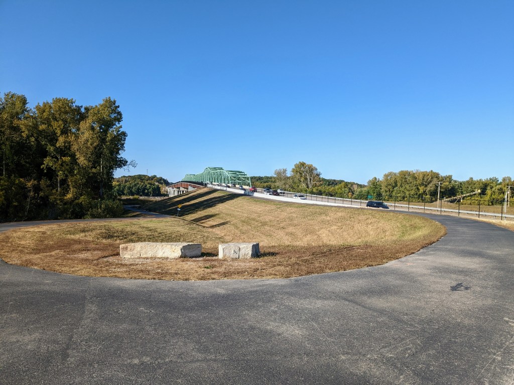
From mile 15, I was running through The Grove and mile 16 was through Shaw. Mile 17 was through Tower Grove Park and the final 2 miles were along Arsenal. By the end of the Run I had crossed over or under five interstate highways, I-70, I-170, I-64, I-44, and I-55.

It was about 30° and partly cloudy for most of the Run with light winds from the East. A little chilly but not as bad as it could have been. My biggest complaint was having to carry around the drawstring bag which was a bit uncomfortable. Even with the small amount of items I had packed. I had to keep switching between carrying it in my left hand and right hand because the strings were digging into my fingers and making them numb.
Overall, the run was an interesting experience but I probably would not run again to or from the airport. Instead I would do my run before or after and take the Metrolink train and Metro buses to wherever I need to go.
-
Daily Run Diary: 2 November 2024 – 5k Time Trial


My training plan called for a 5k time trial run and my coach gave me a goal of 15:45. I was a little nervous about this since my 5k PR was 16:09. I programmed my watch based on my planned splits: 5:05 for the first mile, 5:00 for the second, and 4:55 for the last 1.11.
I slept in that morning and by 2pm, it was 57° with a light wind from the south. A little cooler than the near record highs in the 80s I was used to earlier in the week but still warm enough for shorts and a t-shirt. I ran south for a little over 2 miles, a little over 15 min, then went a little further doing 5 stride outs. My plan was then to run south for half a mile (into the wind), turn around, and run the last 2.6 miles north with the wind at my back.
A few seconds after I started running I looked down at my watch and saw a pace in the upper 4 min range. I knew this was a bit fast but also knew I would lose some time at the turn around. By the time I reached the half mile turnaround, my watch showed 5:10. I was able to maintain it for the next half mile, finishing in 5:09. I was breathing really heavily though, wheezing every other breath.
I tried to increase my speed for the next mile but couldn’t do it, with the wheezing getting worse. I wanted to stop and catch my breath but told myself that if this was an actual race, I wouldn’t be able to do that. I finished that mile in 5:29, 24 seconds slower than I was planning.
I regained a little focus for the last 1.1 miles, thinking less about wanting to stop and just trying to go faster. I kept wheezing and breathing heavily though and ultimately only went a second faster, 5:28 average when I was supposed to run 4:55. After that, I cooled down for 18 min, covering 2.3 miles. By then I was cold and ready to go back inside.
I was pretty disappointed with my overall time of 16:44, being nearly a minute off the goal my coach set for me. I also knew it was on a flat surface (8 ft of elevation change) with light wind and otherwise pretty ideal weather. I’m not sure if the wheezing was from allergies after doing 8 hours of yard work (involving dry grass, leaves, sticks, and probably mold and poison ivy) a few days earlier. Or it could be a residual side effect from having COVID a couple weeks earlier (possibly, but hopefully not, a case of myocarditis). Another strange thing was that my watch showed a very low heart rate for how heavily I was breathing – average of 145bpm and maximum of 157bpm. I was wearing a chest strap heart rate monitor but when troubleshooting, my watch showed it had a low battery, so I don’t trust the results. Regardless, I am planning to speak with my coach to determine the plan for my half marathon race next week, and what information to glean from the time trial.

Garmin Heart Rate & Pace Chart
-
Daily Run Diary: 27 October 2024 Long Jog
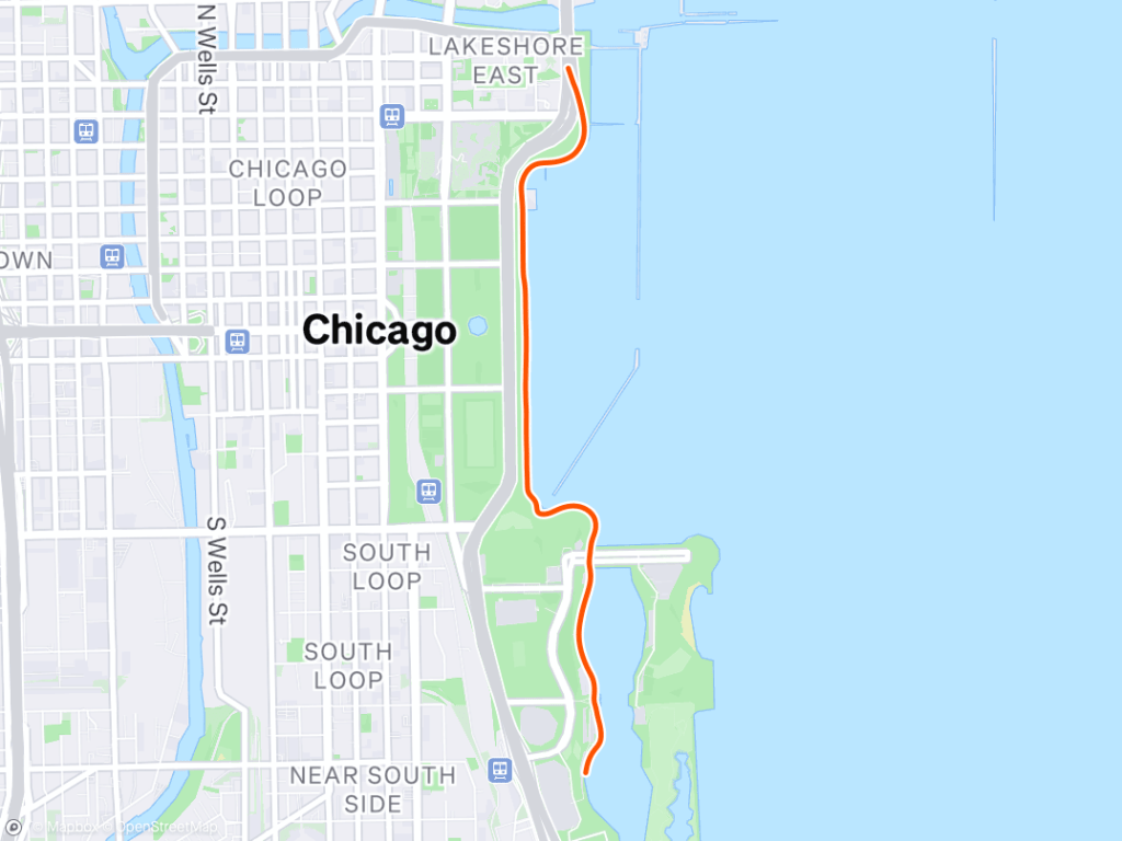
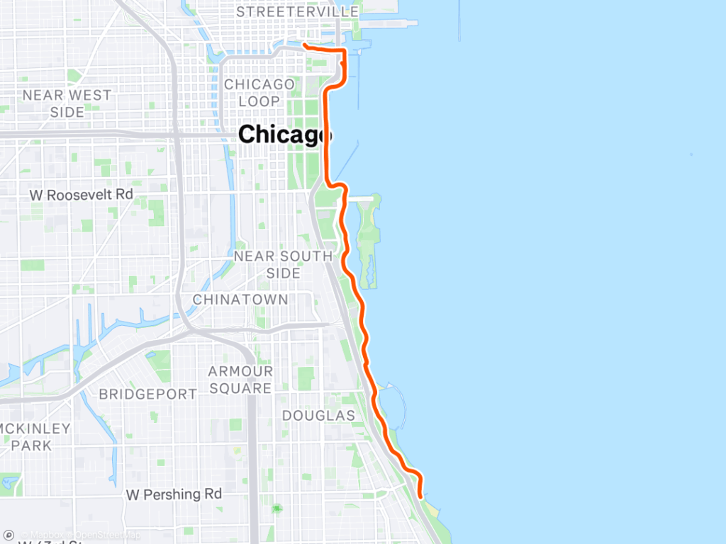
Today I ran 11.27 miles for my prescribed long jog in Chicago. My average pace was 7:15/mile and average heart rate was 147 bpm. This is my first run in the taper phase before my planned half marathon race on 9 November.
-
Carondelet Park Adventure: 12-Mile Workout and Scenery
I ran 12 miles today, the first 4 or so with my coworker, Mike. I kept stopping and forgetting to restart my watch, so I’m not sure the exact distance, but we ran at about a 8:15 pace.
I was scheduled by my coach (more about this in another post) to run around 13 miles so I finished the last 9 miles on my own. By the 4th mile I was pretty thirsty and tried to find a drinking fountain in Carondelet Park. The first one I found near a playground was not functioning so I ran another mile around the park until I found a working bubbler. Although umit was only 82 degrees F, I was still pretty warm so I stopped to take a walk around the park. This wasn’t really the intent of the workout but I don’t go to that park often so I stopped to walk around, and take pictures/videos of the scenery. I’d heard co-workers talking about the cicadas but this was the first time and place I encountered them this year – they were pretty loud. I also walked around the boathouse lake which looked pretty from a distance but up close the water was green and dead fish were floating along the shores.
I stayed at the park for about 30 min, 25 min longer than I expected. It was a nice break but then it was kinda hard to start running again. I ran down some random streets towards work where I started. By miles 10 and 11 I was pretty tired again and slowed to a leisurely walk when waiting for cars to pass through the intersection. Along the way, I was happy to see the formerly derelict Marquette Park Pool filled with children and adults enjoying the warm (and storm-free for once) weather.
I finished my 90 min run near the Save a Lot grocery store just under 12 miles. I ran a few more seconds in the parking lot to get to 12 before going inside. I got some vanilla wafer cookies, frozen pizza, almonds, trail mix, sparkling water, as well as a 20¢ clearance zero sugar Tapout sports drink. It tasted good and had vitamins and electrolytes but I am 100% sure it’s not healthy.
After getting groceries, I walked back to work (much easier than trying to run). I did 2 sets of 20 push ups, 50 sit ups, and 25 assisted pull ups (65lb assistance), then a short ab/core workout (I could barely do most of the exercises, haven’t done these in over a month).
My scheduled workouts for Tuesday, May 28, 2024:
Run
Name: Aerobic Run
Description: Lydiard Phase: Aerobic Conditioning
Workout Priority: 3
RPE: 3 – 5
Heart Rate Min/Max: 144 – 166
Run 1:30:00 at 7:00 /mi pace. You should complete about 12.9 miles.
If you want to adjust your workout, use the following distance, duration and pace guidelines:
Distance range: 9.9 mi – 15.1 mi
Duration range: 1:16:00 – 1:40:00
Pace range: 7:38 /mi – 6:37 /mi
Workout Goal: Aerobic Endurance/Recovery
Take the first mile or so as a warm-up by running nice and easy. Run at a comfortable conversational pace for the suggested duration. Allow your pace to naturally increase so that you maintain a steady comfortable rhythm and relaxed form throughout the run. Always finish knowing you could have run faster or further if you wanted to. NO RACING AT THE END!
The suggested pace is only a guide. Let your body be the final arbiter of the appropriate effort. The pace gets faster as you get fitter. Let it come naturally.
Planned Distance: 12.90 mi Planned Time: 1:30:00Cicadas on a trail in Carondelet Park Boathouse Lake at Carondelet Park Listening to birds and cicadas on a trail in Carondelet Park Listening to birds and cicadas on a trail in Carondelet Park 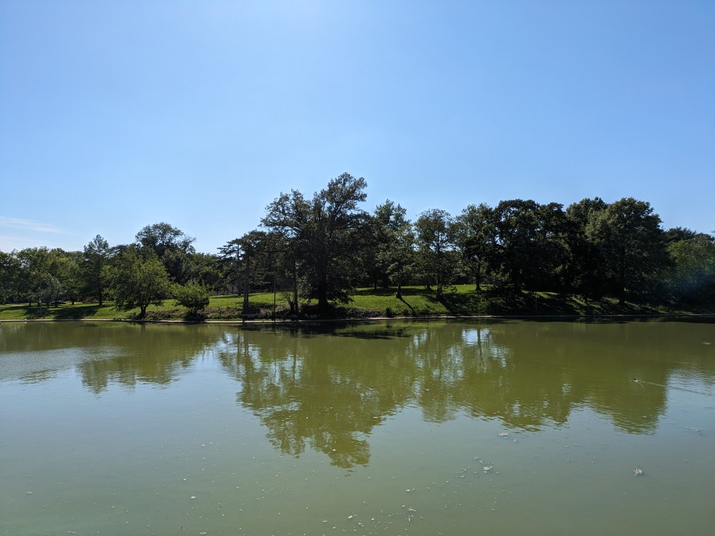

-
November 5, 2022: Ending a 100-mile run week with the New York Marathon Virtual Run in St. Charles, Missouri

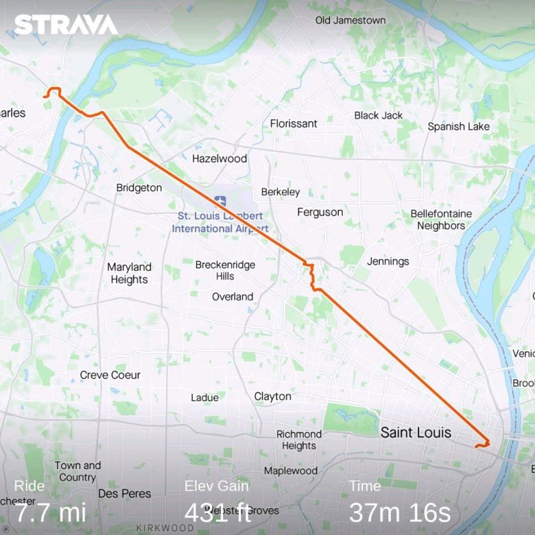
On Saturday, November 5, I went ran with 3 people (2 co-workers) in St. Charles, Missouri. We started running at my friend/co-worker’s house. These colleagues are planning to run the New York Marathon in 2023, and by registering for and running a virtual marathon the same weekend as the 2022 in-person race, they were able to gain guaranteed entry to 2023’s race. I was hoping to instead qualify based on my time in my earlier marathon or half marathon but was happy to join them on their run.
Because I knew we would be running at a slower pace than my typical marathon pace, I did not do much differently to prepare. Normally, runners plan to taper their training immediately before a race, but I ran more miles than usual, hitting 100 miles in 1 week for the first time ever. Running at relatively low intensity and a lower heart rate made this goal easier to achieve.
Not having a car, I took the MetroBus/Metrolink train, and biked again to St. Charles. I slept in later than I originally planned, but luckily the group was flexible. I left my house around 7:00 am, biked to the Forest Park-Debaliever MetroLink Station, and took the train to the North Hanley Transfer Center. It was very rainy when I arrived but luckily again, the bus was already waiting. I sat on the bus for about 10 minutes then we departed. by the time I arrived in Earth City, the rain stopped. I rode along the same route as a few weeks earlier for the MO Cowbell Half Marathon, except this time my bike functioned correctly. This time, it was late enough that the sun had already risen.

Riding down St. Charles Rock Road in Earth City
Riding north down the Earth City Levee Trail
Riding north down the Earth City Levee Trail

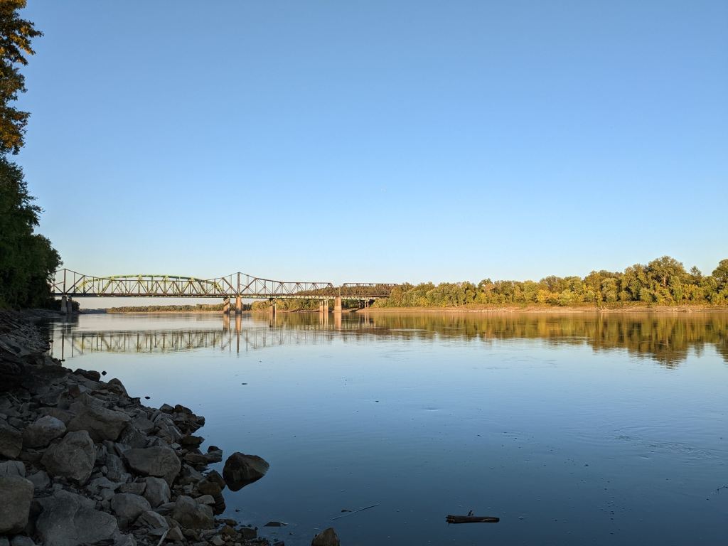
Crossing the Missouri River into St. Charles County
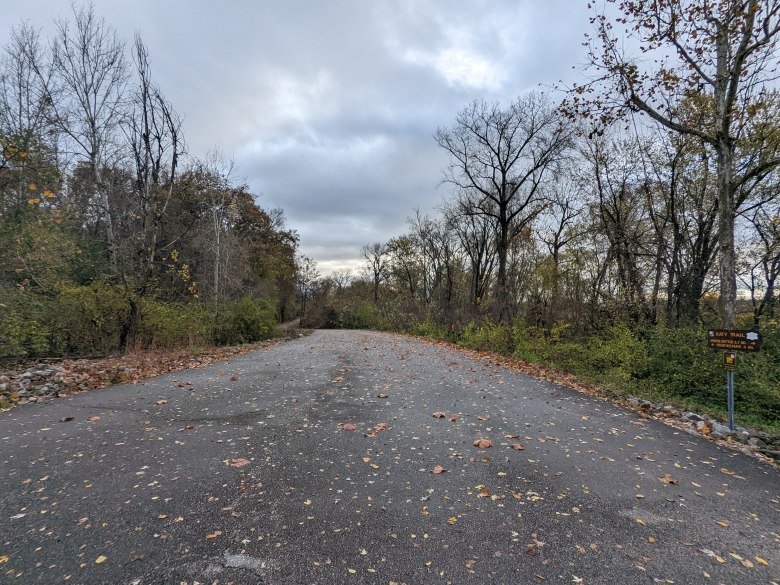
I arrived at the house around 8:15am, about 45 min later than originally planned. Within a few minutes, the 4 of us began running. We ran downhill to Main Street in St. Charles then down the Katy Trail. After three miles, we stopped at a park where my coworker’s husband (also coworker) was waiting as our personal sag wagon. In the next mile, my coworker pointed out Bangert Island where he sometimes likes to run. Next, we ran by an area where the Katy Trail was converted due to construction for the Riverpointe Development. It was a bit ugly at the time with all the trees removed and the trail surrounded by equipment, but hopefully it will be well-connected to other parts of St. Charles in the future so more people can enjoy the trail. Another coworker was also waiting for us along our route, cheering us on near where we lived. It was great to have our own personal crowd and aid stations!
A while later, we met the sag wagon again after passing the Family Arena and crossed back into St. Louis County via the Veterans Memorial Bridge. We ran to Creve Coeur Lake Park, going about 2/3 around the lake before turning around at the Taco Bell Shelter where the group stopped for a photo.

Quick stop at Creve Coeur Lake
Our view of part of the Katy Trail
I was starting to get anxious on the way back, wanting to return to St. Louis on time to take the 3:00 pm Missouri River Runner/Lincoln Service train to Chicago to visit Daniel. But I stayed calm and continued to run with the group. At about 1:40, we made it back to the house, finishing the marathon. I could tell 2 of my coworkers were very tired, especially since one was sick and the other had some foot/ankle issues, but we were all happy to have finished the run, with the three of them qualifying to run the New York Marathon.
View from Bike Flower Park in St. Charles
I left, riding my bike back to St. Louis County. However, it would be almost 2 hours before the Earth City Bus returned, so I instead biked to Hazelwood. Part of my route included riding down Ferguson Ln, parallel to Missorui Highway 37. I know they say not ride through flood water, but I didn’t want to ride an extra 4 miles down busy highways to go around the overflow. Although my feet became soaked from the 6+ inches of water, I successfully made it to the other side.
Flood water I biked through on Ferguson Ln
Another flow of flood water on Ferguson Ln

Hazelwood bus stop (wet footprints from riding through the flood)
I finally arrived at the Amtrak station in St. Louis at 4:15PM. I was over 1 hour late for the train, but, luck for me, the train was late. After securing my bike at the St. Louis Downtown Bicycle Station, I ran to the station, relieved to be able to sit and relax. Before I could fall asleep, I perused the wares and tares of the Amtrak Cafe Car, finding most items were sold out. I reluctantly settled on the turkey sandwich, for a large price of ~$9. It was good to eat something for the first time that day, but was definitely still hungry.


Views of the Mississippi Riverfront from the Amtrak 
View of Post-Harvest Illinois Farmland from Amtrak

Half of my breakfast/lunch/dinner sandwich for the day (I was too hungry to take a picture for the whole sandwich)
At about 10:00pm I arrived in Chicago. I was about 1 mile short of 100 for the week, so I ran (barely jogged) the ~2 miles to Daniel’s apartment from Union Station. With 100 miles
Gear used:
-
Daily Run Diary: October 31, 2022
I ran 18.5 miles earlier today, Halloween. Before that I did 50 assisted pullups, 40 with 45 lbs of assistance, 10 with 52.5 lbs. I didn’t do any pullups last week and it showed when I tried to climb over this past weekend at First Ascent. I also did 100 sit ups and 25 push ups (I meant to do 50 before running but ran out of time – luckily I remembered to do them when I started this entry!) Once again, not having done pushups, I felt pretty weak. I will need to consistently do them to gain strength.
I actually left work at a reasonable time to make it to Monday night’s group run on time. Along the way, I saw some children (and a few adults) trick or treating along Cherokee Street. A guy in front of one business offered me some gummy bears but I didn’t take them.
Later, I heard several fire trucks blaring their sirens as they barreled down Chippewa Street. I definitely make sure to get out of the way. A few minutes later I saw (and smelled) where they stopped, certainly not wanting to stick around for long I hurried down the street to Big River Running.
Today’s group was small, there were a total of 4 of us. One person turned back early, planning to do 3 miles instead of the 7 the rest of us did. Another runner was scheduled to do a 12 mile workout at speeds ranging from 8 min per mile at the beginning to under 7 min by the end. He was talking about his running plan for the week, which included over 70 miles as the peak week before his upcoming marathon in Philadelphia, and a half marathon race in Indianapolis at the end of the week. Definitely a busy week/month for him!
We were pretty lucky, not having to wait at the first few traffic lights, but the luck didn’t last. There were several cars who didn’t see us running and we had to duck out of the way to avoid getting hit. Next time I will have to bring my headlight, especially after daylight savings time ends. I heard that daylight savings was supposed to be phased out this year, but learned that the bill passed in the US Senate but not the House of Representatives. Hopefully they will figure it out someday.
After I finished the 7 miles I ran about 1 more with the guy with the 12 mile plan, increasing our pace to just under 7 min/mile. As he turned around and I continued in the opposite direction, I realized I really had to use the restroom. I had to go a few miles/20 min earlier but kinda ignored it. This time I couldn’t ignore it anymore, so I ran even faster. I considered running to my house since it was only about 1 mile out of the way but I knew if I went in I might know go back out. Instead, I ran to the Schnuck’s grocery store. I practically sprinted through the door and tried to look casual as I passed the security guard, making a bee line straight to the bathroom. It only had one toilet but thankfully I was relieved to find nobody else was there.
Afterwards, I pursued the wares & tares and examined the deals & steals. Most were overpriced but I did find a cherry turnover that was 60% off, so I bought that. It is kind of a way to support the store for being open and letting me use the restroom without having to pay for it. However, if I didn’t find this cheap deal, I probably would have left.
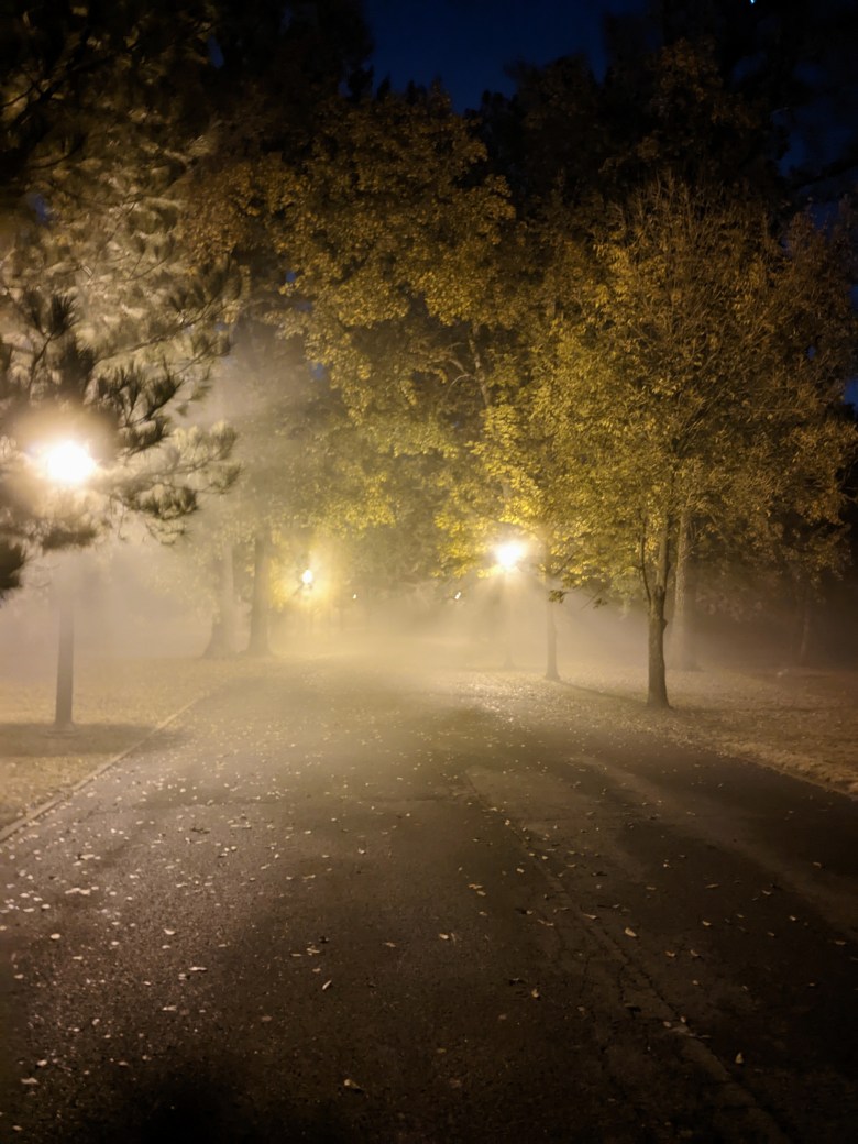
Next I ran around Tower Grove Park. Normally I would have gotten groceries from the Ruler Foods but this week I decided to try Walmart+ that came with Daniel’s credit card. Hopefully the groceries will be reasonable priced and good so I don’t have to walk/run with 20 lb bags again. Tower Grove Park was a bit spooky, with fog eerily illuminated by the sodium orange street lights. At times it was hard to see the trail but luckily I made it back without tripping.

After running a 3 mile lap around the park, I returned home. I passed a surprisingly calm small gray cat, several houses with groups gathering around a front yard bonfire, and a street closed off for a Halloween block party. Several houses had unattended bowls of candy out, and while tempting, I refrained from taking any. Instead I ate some rice and veggies with my cherry turnover, a sweet and super healthy Halloween treat.
-
Daily Run Diary: October 12, 2022

Strava: Afternoon Run Home from Work Normally, I work less than 5 miles from my house. While sometimes I wish the commute was shorter, is pretty convenient compared to my co-workers, whose average commute is 26 miles. However, this week we had a 2-day meeting in Arnold, Missouri, which is a 23 mile drive from my house. Not having a car made this an extra challenge. Looking at the St. Louis Metro Transit Missouri system map, I discovered the closest stops to Arnold were South County Mall via Bus #37 (Carondelet) and the Dierberg’s on Telegraph Rd. via Bus #9 (Oakville). Both would require about 9 more miles of riding. I estimated it would take about one hour to ride from the stop to the meeting site, and had to be there by 8 am, meaning I would have to leave home by 5:30am.
However, at 5:00am, I heard thunder and heavy rain falling, with lots of lightning. It didn’t go away for 20 minutes, so I determined I would have to take an Uber. While this made the morning commute a lot easier, it meant I either had to take another Uber back or return (at least for 9 miles) on foot. I didn’t want to spend another $35, so I decided I would run back.
At about 4:30 pm I, changed into my running clothes and began running. Through Arnold, there were some pretty steep hills, which was a fun challenge. However, for much of the route, it was on a 2-lane road with no shoulder, which was a less fun challenge.
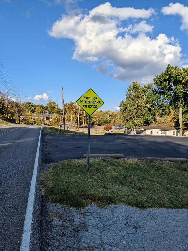
Road sign in Arnold warning drivers about pedestrians Luckily, the drivers weren’t too impatient. After running through some residential areas along Old Lemay Ferry Rd, I crossed over Interstate 55 and ran through a commercial district, complete with Walmart, Target, Aldi, and many other stores. I continued running along Jeffco Blvd until I reached the Meramec River, where I crossed from Jefferson to Saint Louis County. Once again, I saw signs of the exceptionally dry to drought conditions affecting Missouri and other areas to the west in the low water levels.
Meramec River looking west from Lemay Ferry Rd 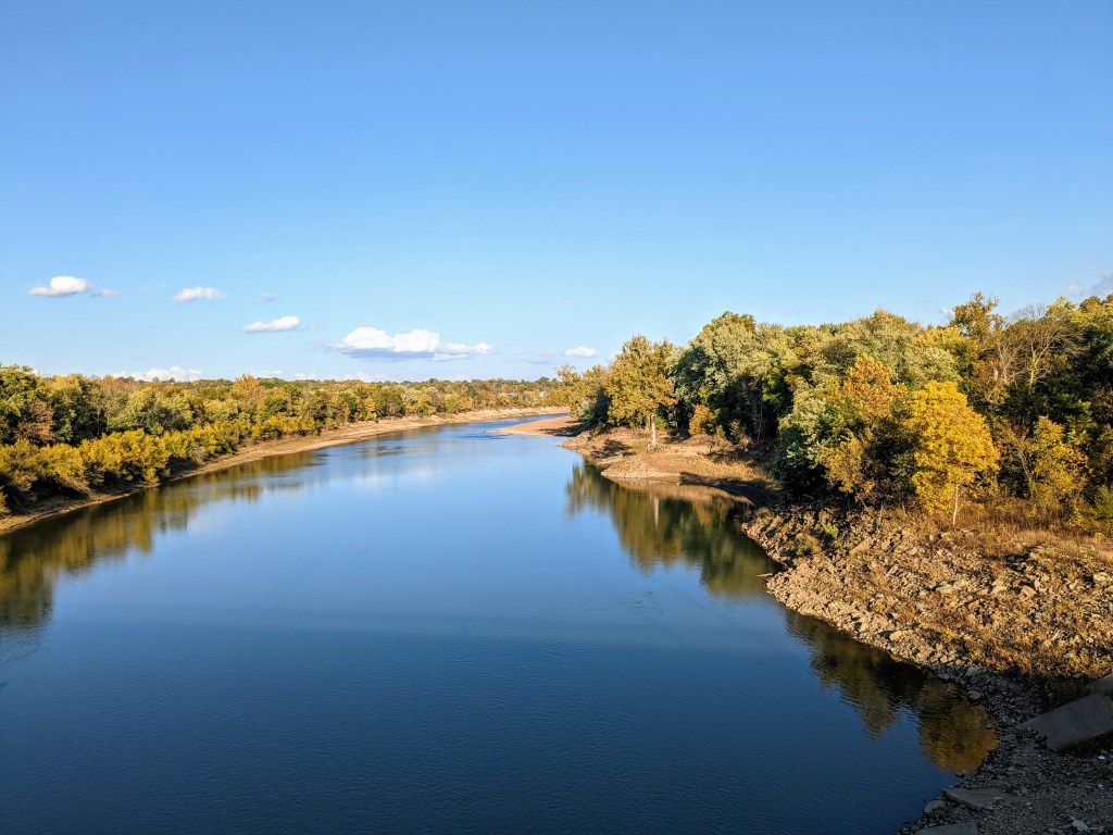
Meramec River looking east from Lemay Ferry Rd While running north on Lemay Ferry, I passed Mehlville High School. It reminded me of the time when I was an intern in 2014 and I rode my cheap mountain bike in the area. I had to abandoned it at the school locked to a bike rack overnight when my plastic pedal broke off. Keeping my bike outside in the winter at school clearly did a bit of damage. I also passed the Kmart where I bought my bike multi tool.
Mehlville High School I continued running northward on Lemay Ferry for what seemed like forever. Every now and then I would have to cross the street because the sidewalk or shoulder would abruptly end.
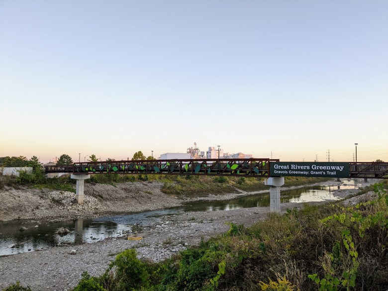
Sidewalk abruptly ending on Lemay Ferry Rd Once I reached Reavis Barracks, I remembered that Grant’s Trail was nearby, so I decided to turn and run there. It would add a little more than a mile to my route but it was worth it to not have to run on the busy road. At the end of the trail I crossed the River Des Peres into the city of Saint Louis.

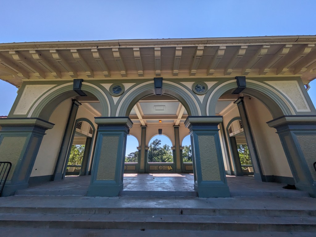
North end of Grant’s Trail crossing the River Des Peres Back in familiar territory, I ran on the River Des Peres Greenway, then turned north at Alabama Ave. The road name changed a few times until I turned to run toward Bellerive Park.

Pavilion at Bellerive Park When I reached work, I had run 19 miles. I could either wait for the bus or continue running home. Not wanting to wait almost an hour, I kept going, finishing with a total of 23 miles.
-
Day 3 of a weekend of biking
Strava: Afternoon Ride 
Strava: Afternoon Run Monday was Columbus Day in Missouri, and a day off of work for me. I decided to go on another bike ride! My co-workers had been talking about Al Foster trail, so I decided to ride there. Google Maps suggested to take Manchester Ave the majority of the way there. Within St. Louis, it has well marked bike lanes, but further west, I wasn’t sure how it would go. At 2:00 pm I left home.
About 20 minutes into the trip, I remembered there was a bus route along the route. I stopped to check if taking it would be faster but discovered I just missed it by less than 5 minutes and the next one would come in 55 minutes. I did not want to wait that long so I kept going.
Another 20 minutes later, I stopped at a Dierberg’s grocery store. I knew it was one of the fancier grocery stores in St Louis, and because there weren’t any near my house, I decided to check it out. Generally, prices weren’t too bad, a little more than the Schnuck’s by my house and a bit more than the Ruler Foods, Save a Lot, or Aldi, but they did have an expansive selection. I found their clearance section and got some sparkling water for $0.25 and blueberry tea for $1.50. After putting on my contacts so I could wear sunglasses, I continued westward.
There was a lot of road construction on Manchester, narrowing the road down to one lane in each direction. While it was a bit uncomfortable not being able to get away from the other cars as easily, it did help that traffic slowed down. In other places, there were two or even three lanes in each direction. I passed major thoroughfares like Lindbergh Ave, Interstate 270, and Missouri Highway 141. It was a bit scary having cars driving fast (the speed limit was 45-55 mph in some places) so close to me, and definitely unnerving when the bike lane or shoulder would randomly end or become a right turn lane.
Finally, I reached Old State Rd, where I turned and headed toward the Meramec Greenway. Past Ridge Meadows Elementary School, I reached the Rock Hollow Trail.
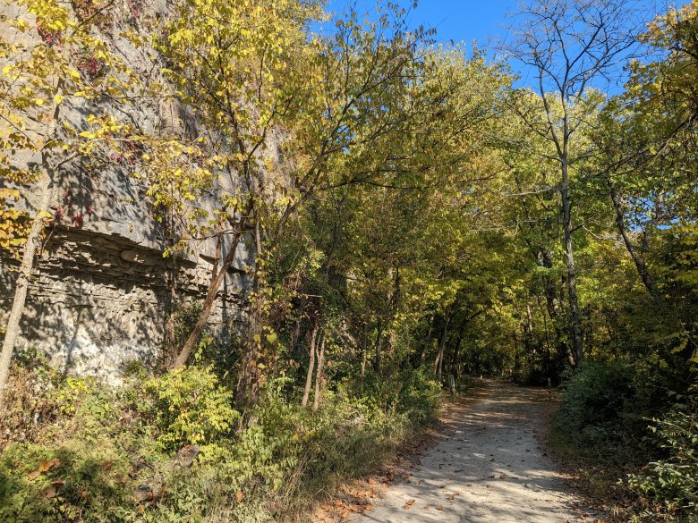
It was a lot of fun to ride, as it was paved, free of cars, and all downhill! There were even about a dozen wooden bridges to ride over. I did have to dodge the occasional pedestrians so I couldn’t go too fast. It was cool to see the foliage starting to change colors on each side and overhead, and there were steep hills to either side of the trail.
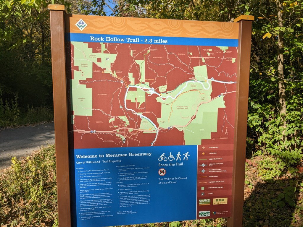
Toward the end of the trail, I passed signs at the intersection of Zombie Trail. It looked like a fun trail to run (or mountain bike on if I knew how) but I would have to save it for another day if I wanted to get back home at a reasonable hour. At the end of the trail was the Al Foster Trail.
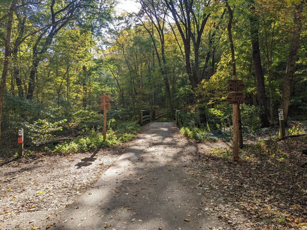
Rock Hollow Trail intersecting with Zombie Trail I rode down the Al Foster trail for a few minutes. It was crushed gravel, so not as easy as the Rock Hollow. I rode over some tiny railroad tracks for the Wabash Frisco & Pacific Railroad. Apparently, the Al Foster Trail is haunted. Reports say visitors experienced unexpected cold patches of air, heard unexplained screaming, and got mysterious scratches on their legs. I did notice my legs were pretty itchy but it was probably from a bug bite the day before or a spider web I rode through (at least that’s what I told myself). Overall, it didn’t seem too spooky while I was there. After seeing the Meramec River, I turned around and started heading back.

Al Foster Trail 
Al Foster Trail 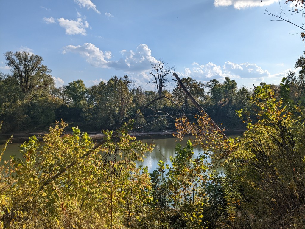
Meramec River from the Al Foster Trail Returning up the Rock Hollow Trail was not as easy, but still very pretty. By 4:30 I made it back to Manchester Ave. Not wanting to ride through treacherous traffic again, I checked my phone and saw the next bus would arrive in 15 minutes. It was much more comfortable on the bus. 45 minutes later I debussed and rode the remaining 2.5 miles back to my house.
On Monday nights, the Big River Running Company has group runs. I wouldn’t make it on time to the beginning but if I modified the route, I could catch up to the group. Probably about 70% of the way into the run, that’s what I did. I ran the last 2 miles with the group, then final 3 miles back home.
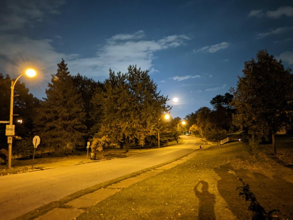
Because the weather was so nice (clear skies, temperatures in the 70’s) and I knew it was going to be cold soon, I went on a walk around my neighborhood. Eventually, I reached Clifton Heights Park which has a nice pond, two fountains, and a plethora of ducks and geese. It was cool to see the nearly full moon rising over the street.
Moonrise over Clifton Heights Park 
Tiny climbing wall at Clifton Heights Playground -
Day 2 of a weekend of biking
Sunday was another lovely weather day in St. Louis – sunny with a high of 68° F. After waking up at noon, I finally left my house to go on another bike ride around 3:00 pm. I started riding down Hampton Ave toward Forest Park. There was a bike repair station here so I stopped to inflate my tires. I have a small portable bike pump with a gauge but it is very difficult to pump to an air pressure more than 65 psi. My tires instructed to inflate up to 165 psi, the most I had ever seen on a bike tire! However, the bike station pump didn’t have a gauge, so I just pumped for awhile until the tires felt extra firm, then continued biking.
Next, I traveled west on Forsyth Ave through Washington University in St. Louis, into Clayton. The city was very clean, although a bit corporate, being the home to St. Louis County offices and pretty empty on a Sunday afternoon. I biked to Shaw Park next, which was where I had to make a decision: Do I ride to Creve Coeur Lake or take the longer route from Chesterfield to ride on the Katy Trail?

Downtown Clayton 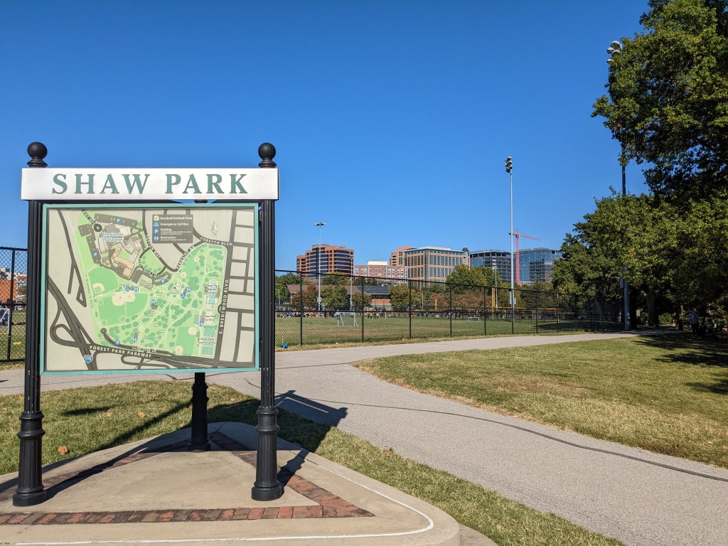
Shaw Park 
Another picture of Shaw Park As I decided to go to Chesterfield, I realized that I could take the bus, shortening my ride through busy suburban roads – but the bus left in either 5 minutes or 65 minutes – from the other side of the Park! I rushed, pedaling as fast as possible, sharing sidewalks and streets with cars, humans, and dogs about to break off their leash. By the time I made it to Clayton MetroBus Station, I had less than one minute until it left. Luckily, there were other people waiting – the bus was late! 3 minutes later I set my bike on the front rack and boarded the bus.
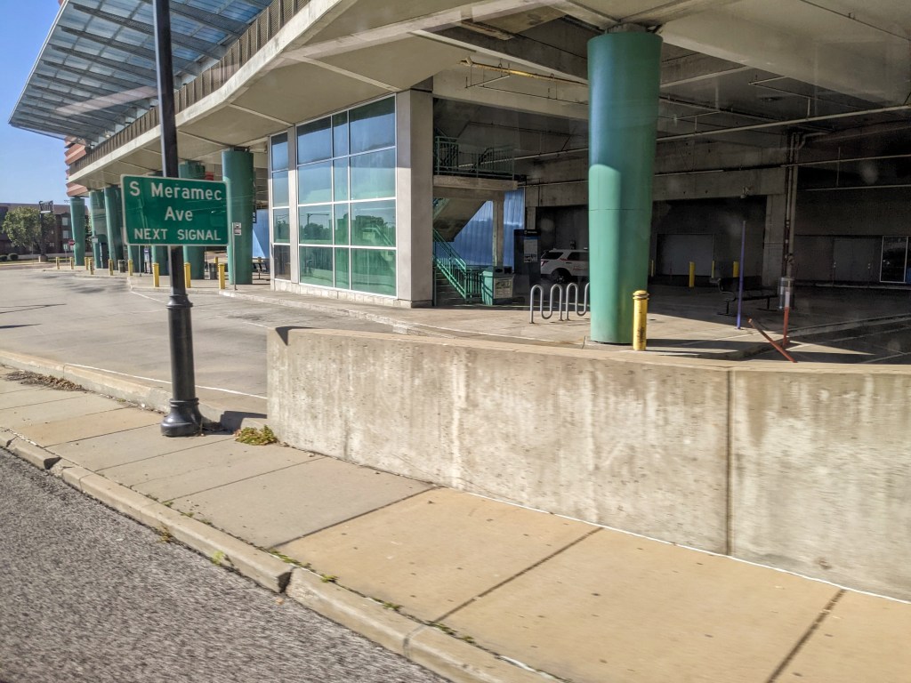
Clayton MetroBus Transfer Station About 35 minutes later, the bus arrived at the St. Louis Premium Outlets in Chesterfield. It looked like a very comfortable spot to wait for the bus (which would be good, since it only comes once per hour). I rode through the parking lot and found the connector to the Monarch Chesterfield Levee trail. I wish the malls my mom shopped at when I was a kid had bike trails like this, that would have been much more fun than walking in circles around Kohl’s or JCPenney’s for hours on end!
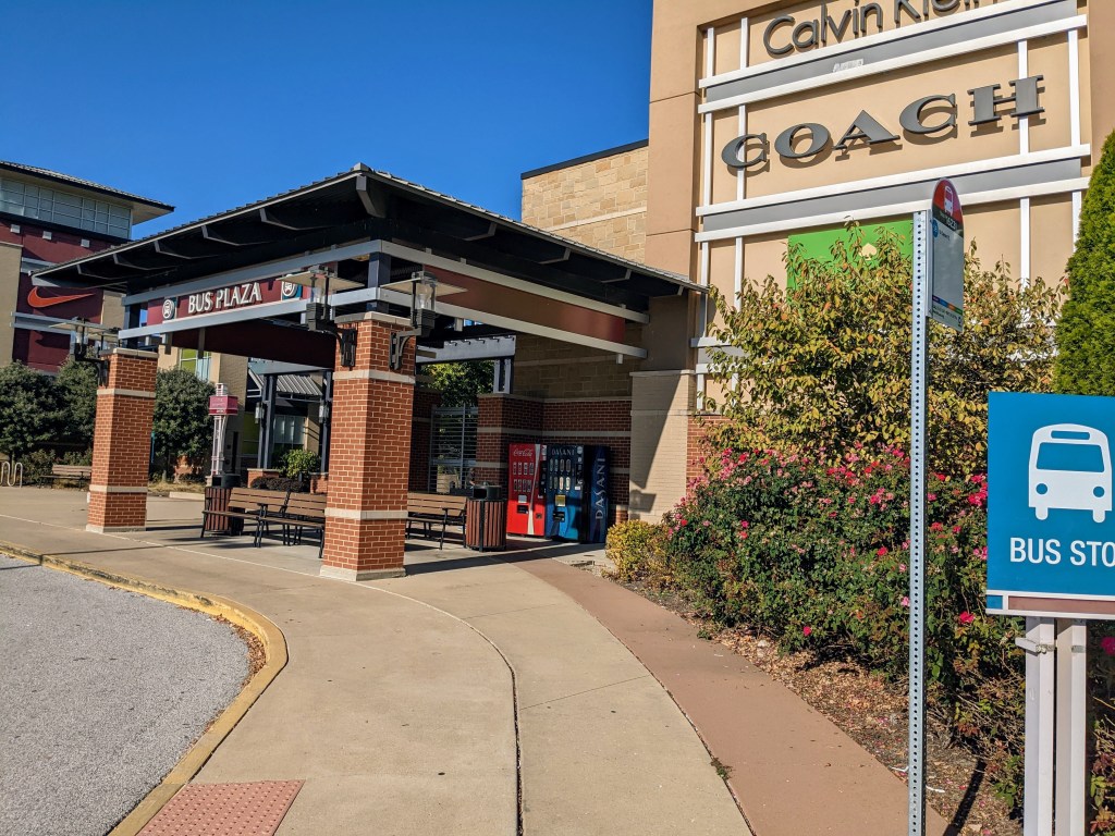
Bus stop at St. Louis Premium Outlets, Chesterfield, Missouri 
Trail connecting outlet mall parking lot to the Monarch Chesterfield Levee Trail From here, I crossed the Missouri River on the Daniel Boone Bridge and made my way onto the Katy Trail. I noticed there were tons of spider webs coating the fence along the bridge. I was just glad the spiders were staying on the bridge and off me/my bike.
Approaching the Daniel Boone Bridge 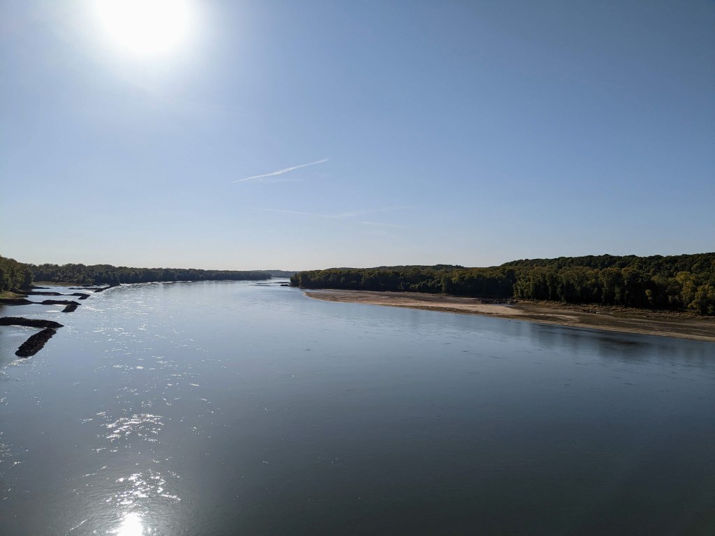
The very low Missouri River, looking west from the Daniel Boone Bridge 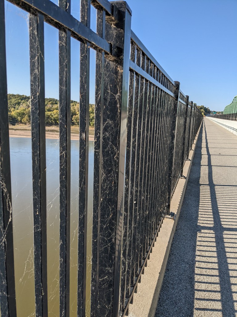
Countless spider webs covering the Daniel Boone Bridge fence 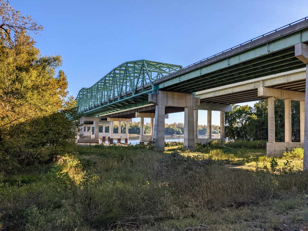
Daniel Boone Bridge, looking southwest from the Katy Trail I then rode for awhile on the mostly tree-covered Katy Trail, which had mostly a finely crushed limestone surface with some occasional larger stones throwing the narrow bike tires off track a bit. Not too bad.

Traveling northeastward along the Katy Trail 
Southwestward facing view behind me on the Katy Trail There were probably about a dozen people every 5 miles on the trail – a mix of people running, walking with their dogs, and biking. The rocks were evidently bumpy enough to knock the water bottle holder off my bike. I tried to grab it without stopping and was able to prevent it from falling on the ground, but couldn’t pick it up. I gave in and stopped, retrieved my multi-use tool (probably the last thing I ever bought from Kmart) from my saddle bag and quickly reattached it.
Road crossings broke up the path, mostly uneventful, except for one blind corner on Green’s Bottom Rd. Luckily, I saw the SUV coming around the corner in time. Surviving the intersection, I was rewarded with a beautiful view of the autumn foliage reflecting perfectly on Duckett Creek.
Blind corner on Green’s Bottom Rd. near trail crossing 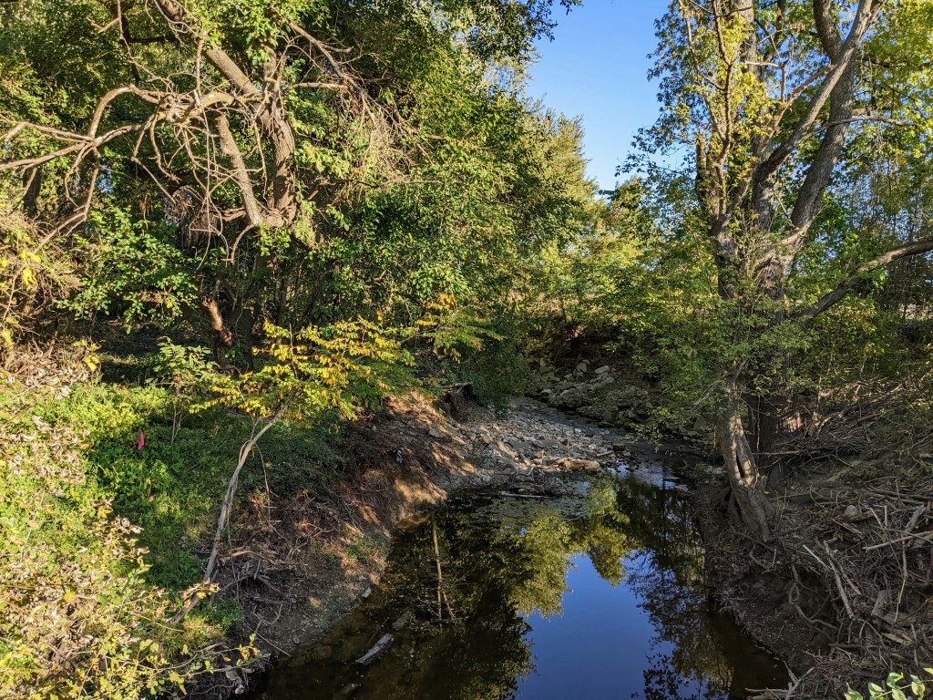
Looking east at Duckett Creek I continued down the Katy Trail until I reached Bangert Island Park. My friend/co-worker Mike told me about this place where he runs sometimes. By now it was 5:00pm. I had again wanted to go to Pere Marquette State Park but knew I wouldn’t make it there before dark so knew if I wanted to run during daylight hours, I would have to do it here. I looked at Strava and saw several running routes, including one segment with a course record of 5:59/mile. Maybe I could beat it! Before I knew it I was running down dusty, sandy, rocky paths. A nice change/challenge. I got a bit lost going down some unofficial paths, and ended up much slower on the segment, 7:08/mile. Harder than I thought!

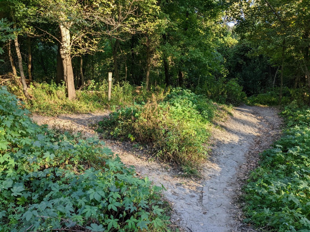
A fork in the trail at Bangert Island 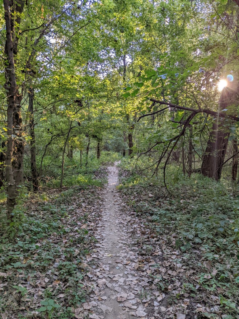
One of the Bangert Island Trails 
Missouri River from Bangert Island
Onward, I passed an AMC movie theater and under I-70 via the Blanchette Memorial Bridge. Next I reached Frontier Park, a very familiar place – the finish line of the previous week’s half marathon! I refilled my water bottles and continued northward.
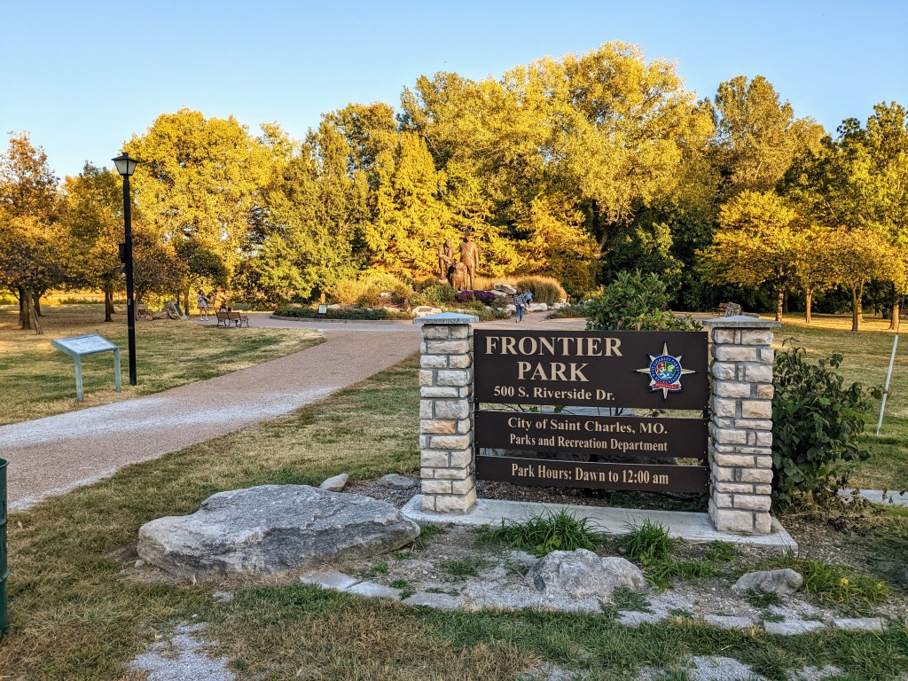
Frontier Park 
The Bike Stop Cafe where I ate and tried to have my old bike fixed the previous week Eventually I reached a point, Dusable Park, where I needed to diverge from the Katy Trail and travel on Missouri Highway 94. Riding with traffic along the highway was not great but most drivers were courteous and gave me space. The road went past Boschertown Go Karts, through several miles of corn field, broken up by houses, one or two gas stations, churches, and schools. Road traffic was too busy to take a photo of the exact moment of sunset, but I watched the sun dip below the horizon while a farmer was using a combine to harvest corn. Maybe it was fueled by dust from the harvest, but the sunset was very beautiful. Turning down a local road, I passed Smartt Field Airport, and reached the southern terminus of the Grafton Ferry.
One last picture of the Missouri River looking northeast from DuSable Park 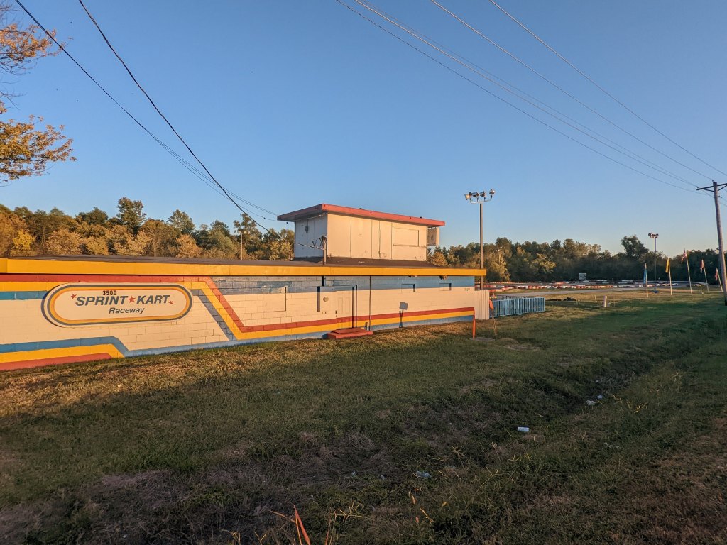
Boschertown Go Karts 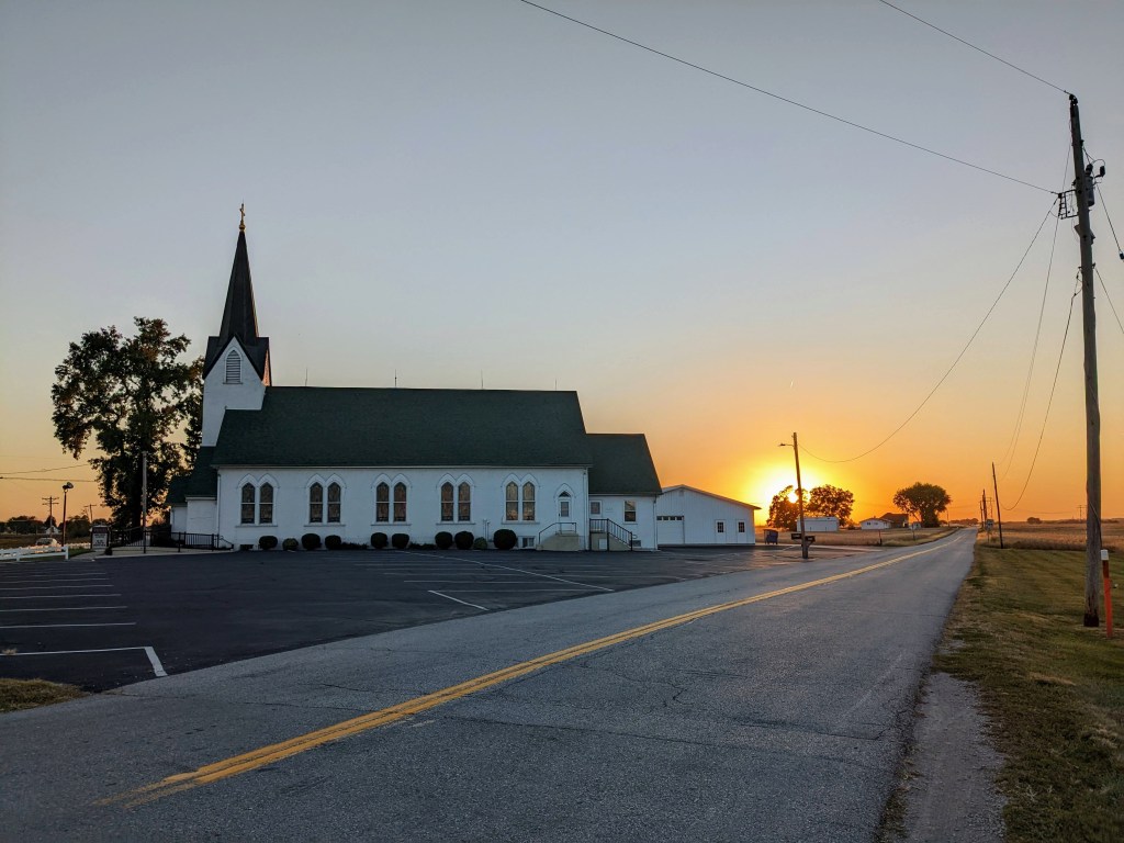
Almost sunset behind Trinity Church in Orchard Farm 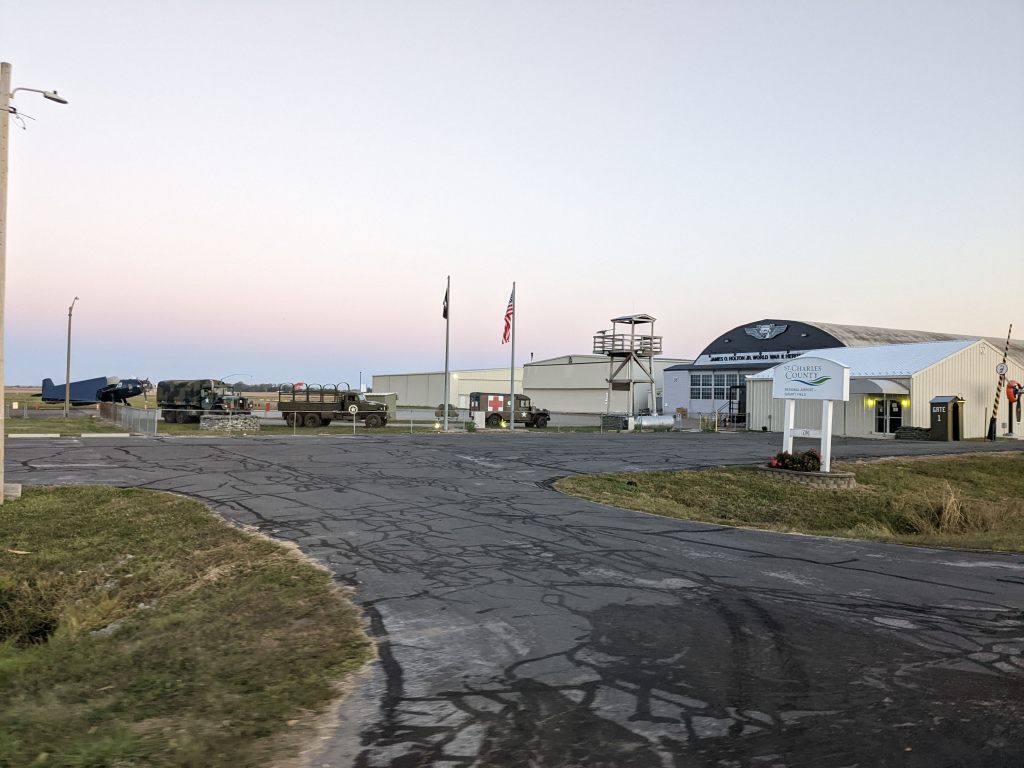
Smartt Field I just missed the ferry by about 2 minutes (probably all the stops taking pictures). I didn’t mind, it gave me a chance to eat a Gala apple I packed and add some layers of clothes. I noticed the rear brake had also shaken loose so I tightened that. About 10 minutes later, the ferry returned with cars traveling south from Illinois to Missouri. There was nobody else in line, so for $5, I got my own private cruise! More beautiful views, this time of the Mississippi River.

Watching the ferry leave right after I got there 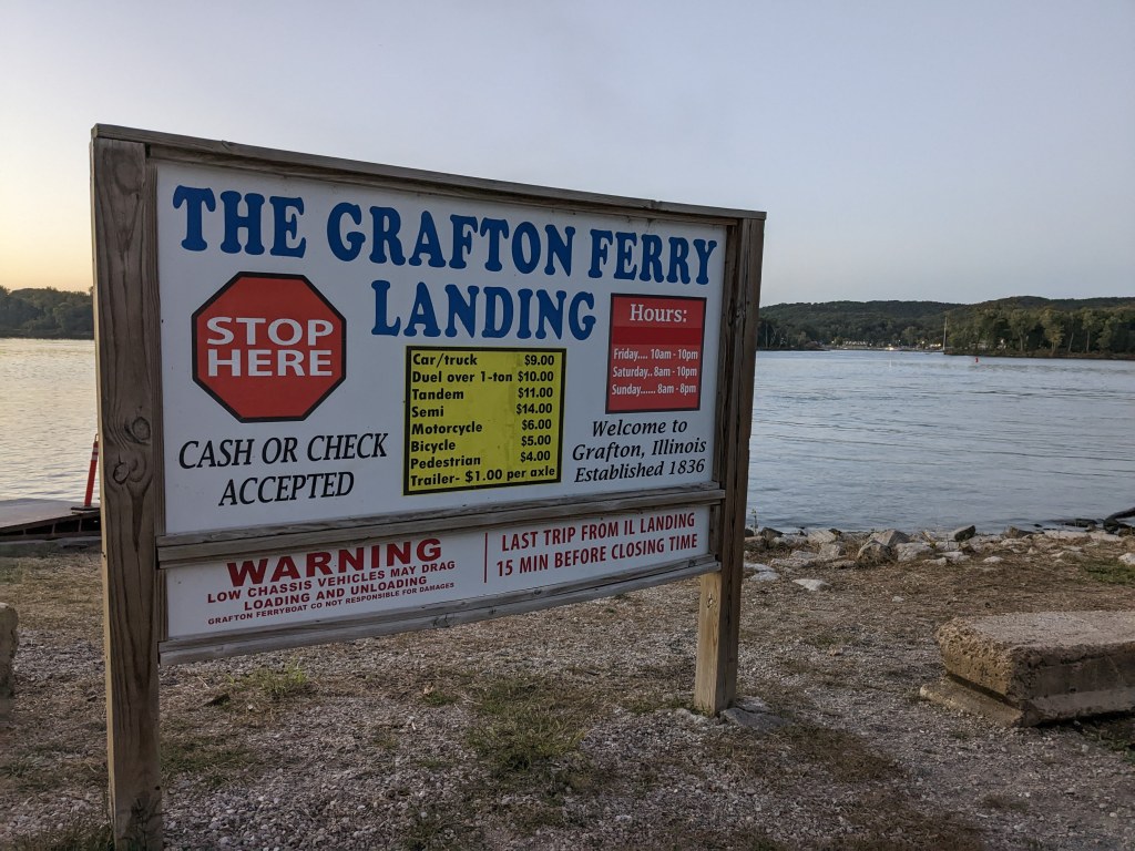
Grafton Ferry prices 
Watching the sunset over the Mississippi River, departing Missouri 
I had the entire ferry to myself 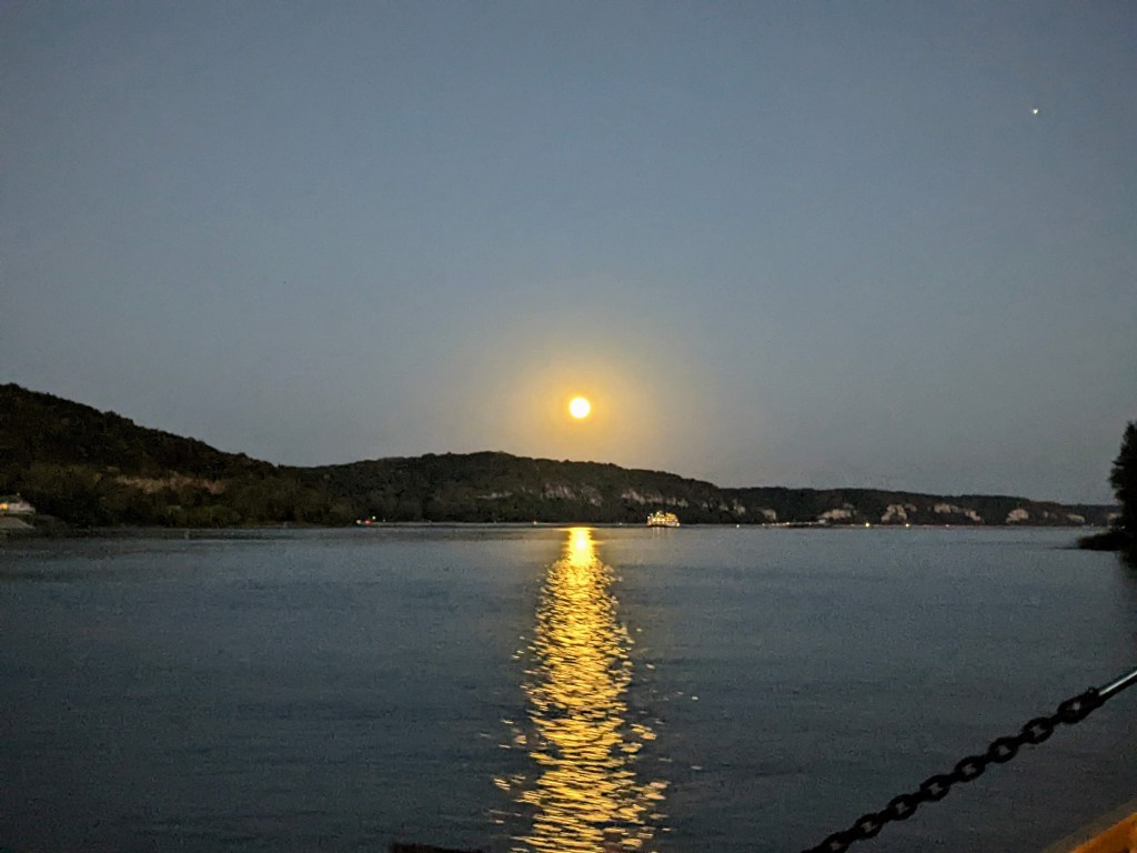
Moon rising over the Jersey County, Illinois bluffs along the Mississippi River
From Grafton, I rode east on the Sam Vadalabene trail, following the Great River Road. It was warmer than I though (probably the river effect – I felt it earlier and it was quite warm), so I took off 2 of my 4 layers (a little overkill but it was really cold the day before!). The Piasa Bird, Ardent Mills and Argosy Casino landmarks welcomed me to Alton. I felt like I was almost home, but really still had over 30 miles to go! To be fair, the Amtrak takes about an hour to get between Alton and St. Louis.

Hoffman Gardens bluffs along the trail 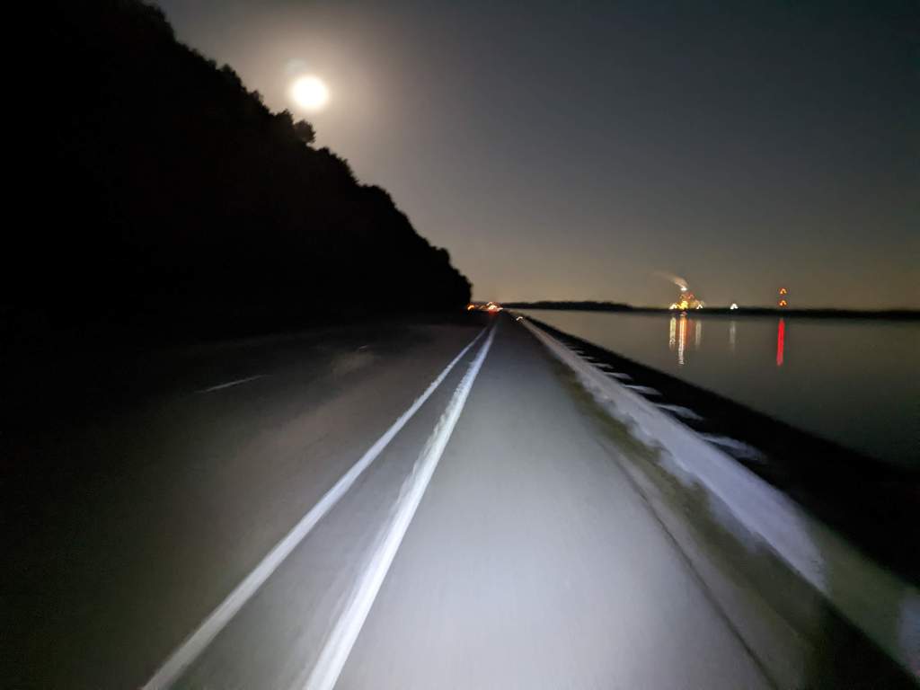
It was pretty dark along the trail, I’m glad my bike had its light! 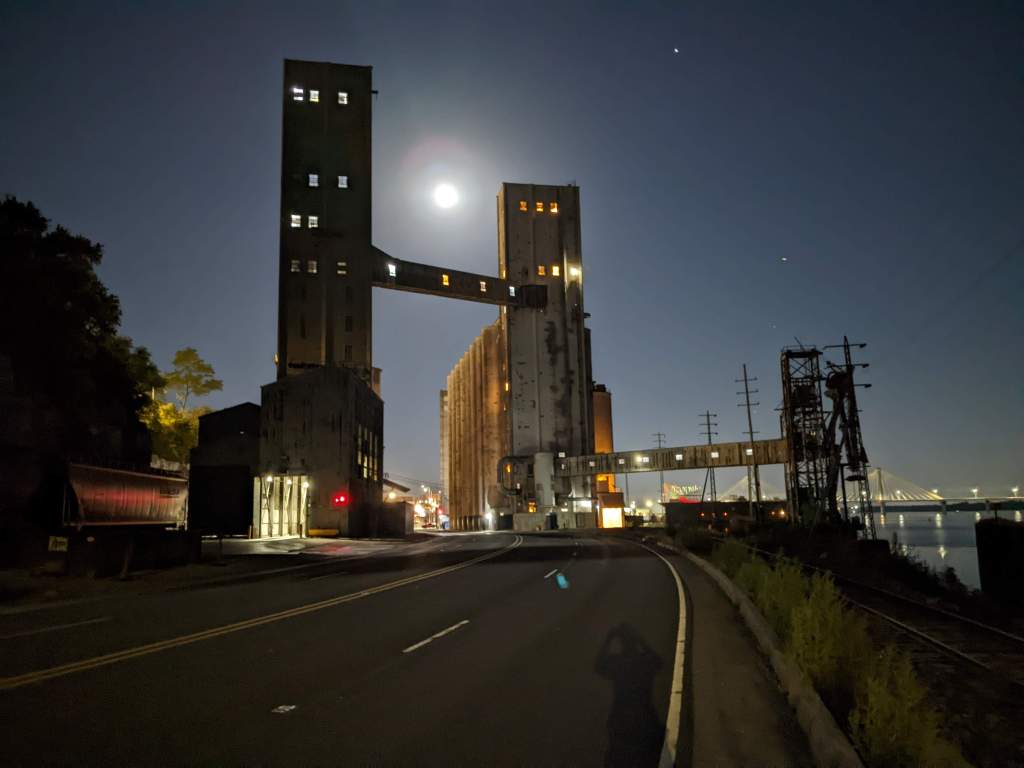
Ardent Mills looking spooky under the moonrise 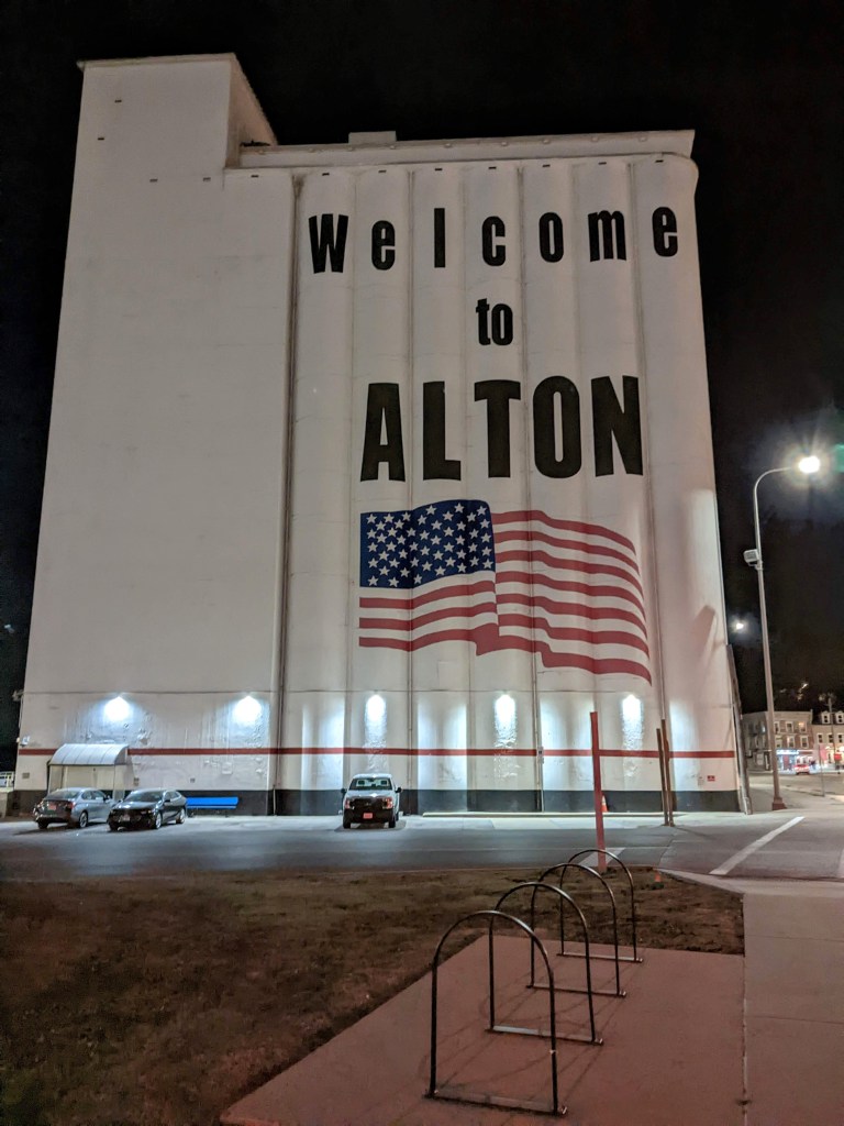
Ardent Mills welcoming you to Alton From Alton, I continued down the trail past the Melvin Price Locks and Dam through Hartford, where I stopped at a Casey’s gas station to use the bathroom and get a few snacks. I saw a McDonald’s in Alton and was tempted to stop there but forced myself not to! However, maybe because I was spoiled by Daniel’s chocolate selection, was a bit disappointed with the 2 for $2 chocolate candy bars. Nonetheless, they gave a helpful boost. Riding along the Madison County Transit Confluence Trail was quite annoying with large rocks and small patches of broken pavement interspersed with very loose gravel. I was happy when it ended near Granite City.
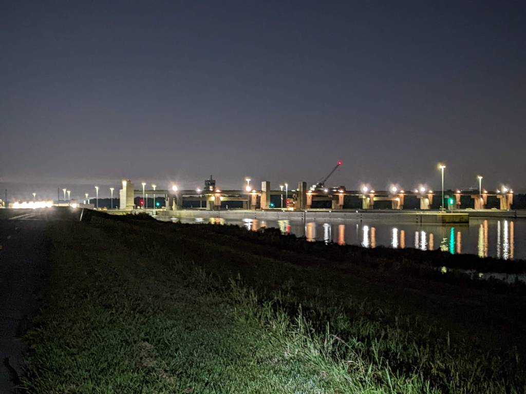
Melvin Price Locks and Dam 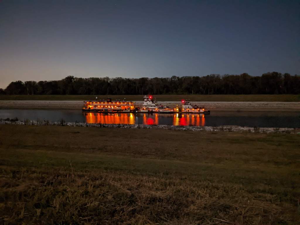
Boat on the Chain of Rocks Canal, viewed from the Confluence trail 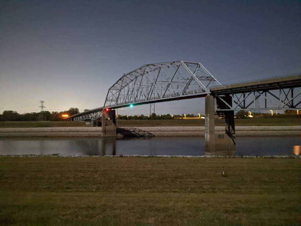
Looking north towards Chain of Rocks Canal Bridge 
Example of the loose rock atop the levee on the Confluence trail 
Bales of hay along the trail seemed to glow in the moonlight 
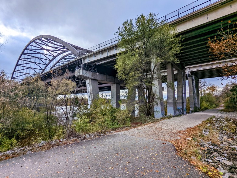
Construction on the Merchant’s Bridge (explaining why the Amtrak is often late arriving in St. Louis) Finally, I reached the McKinley Bridge where I crossed back into Missouri. I was extra careful riding, trying not to hit broken glass, trash, discarded furniture, who knows what else. Around 10 miles later I arrived home, finishing 84 miles of riding. I was happy I had leftover homemade soup and crackers to eat, and quickly fell asleep after.
Crossing into Missouri on the McKinley Bridge 
Endless trash along the bike/pedestrian path 
Downtown St. Louis and the Stan Musial Bridge, with a mini arch in the Mississippi River 
Leftover chicken soup for dinner (it tasted better than it looks)/ 
Leftover homemade crackers -
Daily Run Diary: A day off from running
Normally on the weekends, I take the Amtrak from St. Louis to Chicago to visit my partner Daniel. However, this week, starting a couple of days after the half marathon, I became sick. I don’t know if it was a cold, allergies, or something else, but on Tuesday, I started sneezing a lot during my bus ride to work. My co-worker asked me about my weekend, and after I told her about the race, she said my voice sounded different. Another co-worker later commented that she was hearing a lot of coughing around the room. At the time, I thought it was just allergies from doing extensive yard work, but my condition devolved throughout the day, with runny nose and sneezing getting worse. I tried drinking some herbal tea, which helped me feel a little better at the moment, but I knew it wasn’t going to be enough. The next three days I took some sick leave, staying home from work (except for a few hours to submit my timesheet – don’t want to miss out on getting paid!)
While I had a hard time sleeping from not being able to breathe/a runny/stuffy nose/sore throat, I still ran on my own. I found that, although it was harder to breathe and my heart rate was a bit higher, I didn’t notice any sneezing or runny nose (although it came all at once as soon as I stopped). Not wanting to infect Daniel, I unexcitedly cancelled my trip northward that weekend.
With a full day off, I decided to go on a longish bike ride. I wanted to go to Pere Marquette State Park but knew leaving at 2:30 pm (by the time I fixed my bike and got all my gear/clothes packed) would be too late. Instead, I planned to ride on the Madison County, Illinois Transit (MCT) Trails, after seeing countless Strava entries from bikers I followed.
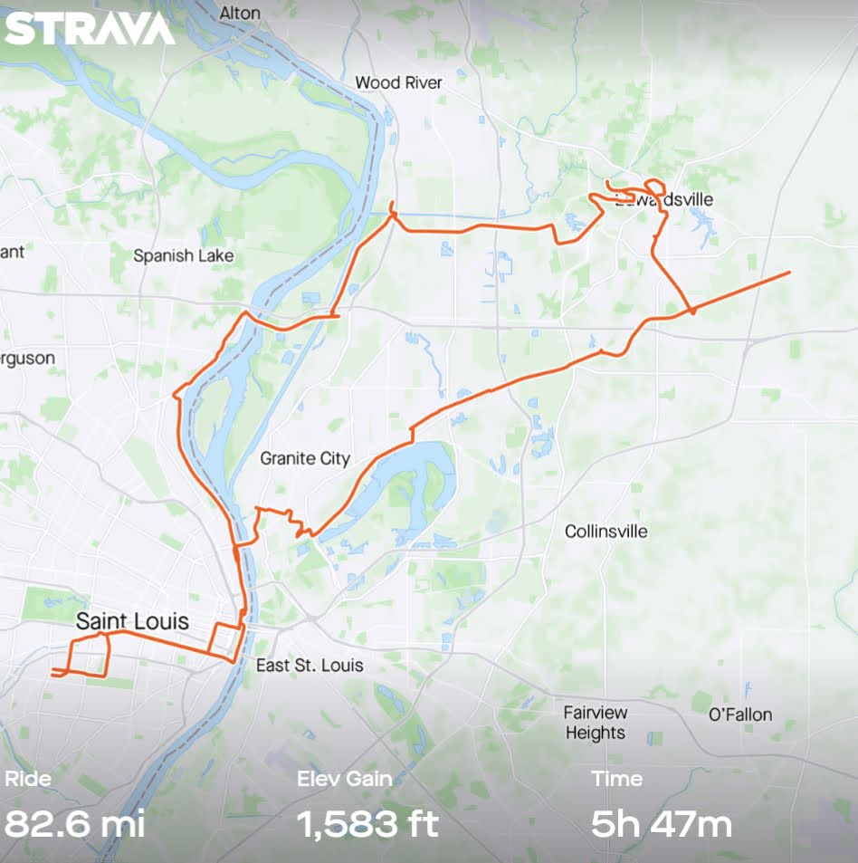
Within the first mile, I picked up and discarded a run-over flexible reflector that fell off the bike yesterday. Around 7 miles in, I passed the Arch. Just north of it, a homeless camp was growing, right along the flood wall which closed the trail for a short section, sending me on a detour along the Horseshoe Casino. After that I passed what looked like a festival near a bunch of abandoned buildings and the Ashley Energy facility.
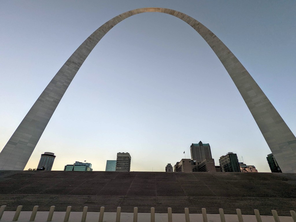
The Arch (taken during my run the night before the bike ride) 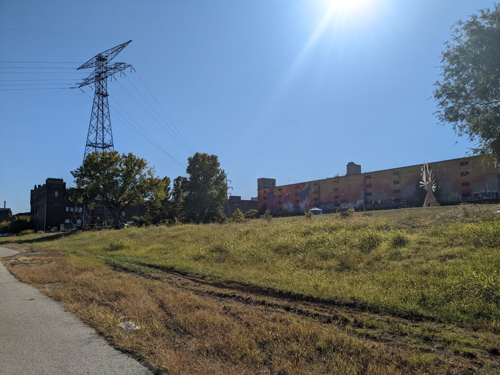
Some kind of structure I saw at the festival at the abandoned building From there, I continued northward on the Riverfront Trail past the Mary Meachum Freedom Crossing, to the Chain of Rocks Bridge. This was probably the lowest level I had ever seen for the Mississippi River. In 2021, this route (in reverse) was the course for the GO St. Louis Marathon. I crossed the river into Illinois, and continued on the Confluence Trail. Next, I stopped to refill my water bottle at the Lewis & Clark Confluence Tower. From there, I rode down New Poag Rd. to Southern Illinois University-Edwardsville. Several of my co-workers went to school there. It was nice, albeit isolated, very spacious and scenic with plenty of forests and small hills. Next I rode through downtown Edwardsville where numerous high schoolers were taking photos for homecoming (I saw a sign for at at a local theater).
East end of the Chain of Rocks Bridge 
Looking south toward St. Louis on the Chain of Rocks Bridge 
Looking north towards Alton on the Chain of Rocks Bridge At the end of the Watershed Trail, I got a bit lost but eventually found my way to the Goshen Trail. I had planned to ride all the way to Marine, IL before turning back but at 6:00 pm, I realized I still had 6 miles to go and it would likely be past sunset before I even got there. In 2017, I clumsily collided with a bollard, flying several feet into the air before slamming into the ground (luckily I had a helmet on), while riding at night and didn’t want to do that again. So I turned around and headed back toward St. Louis. By then the temperature was dropping, it was 50° F (but felt much colder).
Looking east over Cahokia Creek on the MCT Goshen Trail 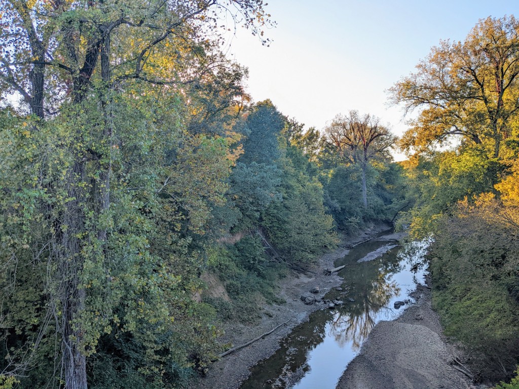
Looking west over Cahokia Creek on the MCT Goshen Trail 
The moon rising as I decided to stop early and turn around 
My bike next to a bollard which I had mistakenly hit before I only ate a small lunch and was over 50 miles into the ride by the time I reached Glen Carbon. There I spotted a Casey’s gas station. I remembered my credit card had a special promotion there (I think a whopping 5% off), so I went in to get some snacks (some 2/$4 candy and a pack of gum) and put on another layer of clothes.
The last 30 or so miles were kind of a blur. I was just trying to ride fast enough to not get too cold. I got a little lost at the end of the Schoolhouse Trail in Madison, IL but eventually found my way to the McKinley Bridge and back into Missouri. A few more miles through downtown, and along some bike lanes and I was finally home around 9:45. The grand total was 82 miles for the day, the most I’d ridden since probably 2019. I was exhausted, starving, and glad I had leftover soup to eat for dinner. I looked at my watch and saw that I walked less than 2,000 steps for the day, about 10% of my official Garmin step goal – what a slacker!
-
Subscribe
Subscribed
Already have a WordPress.com account? Log in now.
